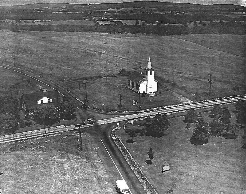
Rich and I have looked for TT 27 T a few times without any success. Today we came back with our metal detector, hoping that we could at least positively identify its location, if not actually dig up the church yard and fully recover the disk. A groundskeeper was mowing the grass. Great! we thought; if there’s still a monument here, he must know about it. But he had never seen any such monument. He did explain that he was pretty sure the front yard of the church had been regraded at some point.
The description doesn’t give any dimensions or distances from the church, and the roads have probably been widened in the meantime, so we really don’t know for sure where the mark was located. PennPilot imagery and an image of the church taken from their website are also less than helpful. We searched the entire front and side yard of the church by eye and with the metal detector without any luck. The mark is either gone or buried, with little hope for future recovery and use.
Connected to Finch Hill Corners is this nostalgic, endearing, and rather bizarre bit of folklore: Finch Hill Corners, the 4 Corners of Life. It was new to me, but Rich remembers hearing the tale when he was younger.
After this slight disappointment at the church, we moved on to the next mark on our list for today. And … well … our return trip to search for USGS bench mark disk TT 16 T was a success. It was also the scene of an ugly confrontation!
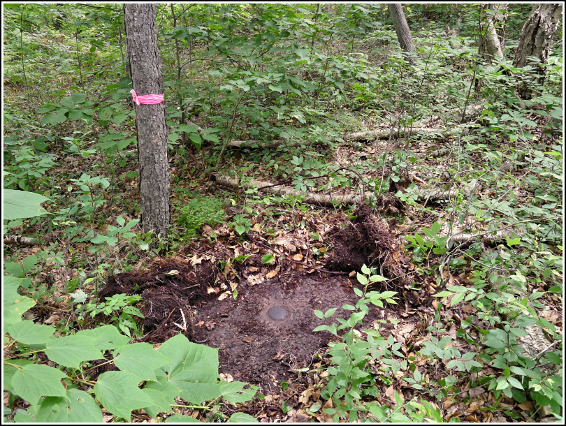
At first everything went smoothly. Just like we did a week ago, we parked along Flat Rock Road and made our way along the high ledge toward the coordinates. Armed with a metal detector this time, we were confident we’d be able to find the mark. Our “best guess” last week turned out to be just a few feet off—today, the metal detector and some light scraping were enough to confirm that we had found the mark.
I returned to the car to retrieve a measuring tape and our camera tripod. That’s where I made my mistake. Apparently either the beep-beep of the remote keyless entry system or the sound of the trunk closing was enough to summon the “neighbors” from their lair. But I wasn’t yet aware of this.
I returned to the woods, where Rich was cleaning up and documenting the disk. Fortunately we were able to take some photos and measurements before the insanity began. Within a few minutes, a bitchy voice was hollering to us from the road. “Who’s in there?” and the infamous “Can I help you?” Rich yelled back that we were looking for a survey mark. She started screaming that we were on her grandfather’s property, blah blah et cetera. Nothing we haven’t heard before.
Usually we can talk these people down by explaining the purpose of the mark and how cool it is to have one on your land, but this woman (and her daughter, who had joined her by the time we made our way back out to the road) would have none of it. She just kept screaming about how the land belonged to her grandfather, Fred Seana.
We explained that if there are any houses in the vicinity we always ask for permission, especially if the land is posted. There were no posters, as we could all clearly see, and no houses anywhere nearby that we could see either. The woman was just a total nutcase. She kept insisting that there was a poster on a tree that was obviously entirely bare. We tried to show her the photos and the datasheet, but she wasn’t interested. We got out of there before the situation could become uglier.
The disk is in excellent condition on a high outcrop running east-west. The outcrop is in a wooded area southwest of Flat Rock Road. Later investigation showed that a Frederick Seana owns land north of Flat Ridge Road, while the land south of the road belongs to Nip and Lillian Seana of Honesdale.