Q: Which of the two would you expect to find in northeastern PA?
- A man selling cactus
- An easy way across a swiftly flowing creek
A: The cactus man is real, and the creek crossing didn’t happen.
Last week’s adventures took us west on Route 6. This week’s took us east.
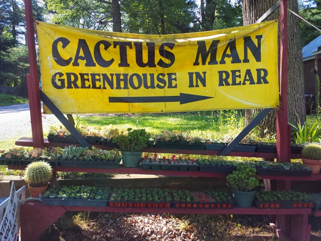
As we passed by what looked like a typical old-fashioned Route 6 trinket shop near White Mills, I saw this:
“WHAAAAAAT THE …?! I just saw a sign that says Cactus Man, and lots of golden barrels!”
Rich had no idea what I was talking about but he was already looking for a place to turn the car around.
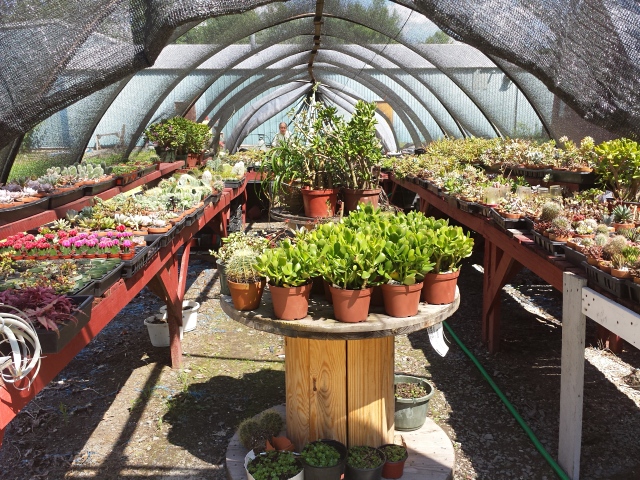
It was indeed a roadside “emporium” featuring cacti among other things like scented candles, driftwood trinkets and dusty alien-head lapel pins circa 1989. But for us, and apparently for the Cactus Man, the cacti were the main attraction.
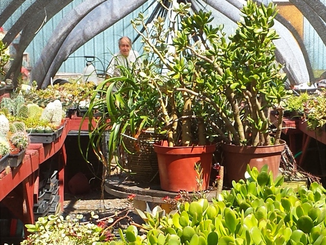
The huge barrel cactus near the entrance drew our attention first, and at a price of $68.50 I probably would have bought it if it weren’t in dire need of a repotting. (Rich and I managed to repot our 9 inch barrel recently, but it was a tricky, prickly task.) We headed directly to the greenhouse and the Cactus Man ambled over, willing to answer any questions. Or maybe just desperate for company. Either way, he was a smiling, slow-talking character of the kind you only find these days along old roads like Route 6. He’s been in business in this location for 46 years—how did we never spot him before? We were happy to do business with him.
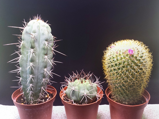
We ended up with a bright green Gymnocalycium, a tall, blue-hued Stetsonia coryne, and a plump flowering Mammillaria rhodantha (the aptly-named Rainbow Pincushion).
The shortest of the three cacti, the Gymnocalycium, fit perfectly into one of the front cupholders. The other two settled snugly into the back seat cupholders, and they all came along for a ride into the gamelands.
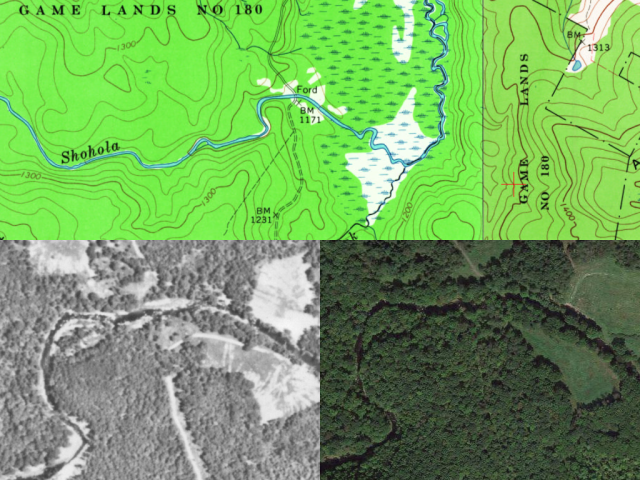
For a few weeks I’ve been interested in a few benchmarks in Pike County, where we haven’t hiked in over a year. One of the more intriguing marks is C 237 (LY1138).
When it was placed in 1959, the benchmark was easily approached from the south via a network of game roads. Now it’s on a small finger of land neatly sandwiched between I-84 and Shohola Creek. The only known way (to us, anyway) to access the area is from the north, via a woods road in State Game Lands 180.
We found two different maps of the gamelands that show slightly different trails, roads, and parking areas. It seemed likely that we would be able to drive—or hike, if the road were gated—to the extreme southern end of the road and then hope for a way across the creek. The benchmark’s description mentions a swinging bridge over the creek. A swinging bridge is just far too cool to hope for, and is probably long gone, we realized. But it was at least possible that there is still an established method for crossing the creek: maybe a culvert was installed, or stepping stones, or even a simple cable bridge.
The decision of whether to drive or hike was made for us by the locked gate across the road just beyond the boat launch parking area. We parked in that lot and began our hike. The benchmark’s coordinates were 2.3 miles distant (that’s a straight-line distance). The road was a typical gamelands woods road: gravel-surfaced, rocky in spots, with undulating hills and occasional unmarked trails leading off the main road, both toward and away from Shohola Lake.
The day was warm, hot even in the sun, and soon we found ourselves swatting at flying insects. Then more came, and more, until they were swarming both of us. They were small brown flies with spots or stripes on their wings. More remarkably, we discovered over time that they were much more active both in the sunny areas and when we were moving. Most bugs are more of a bother in cool, shady spots and when we’re still. I have no idea what they were—deer flies, maybe. I’m going to call them Opposite Bugs.
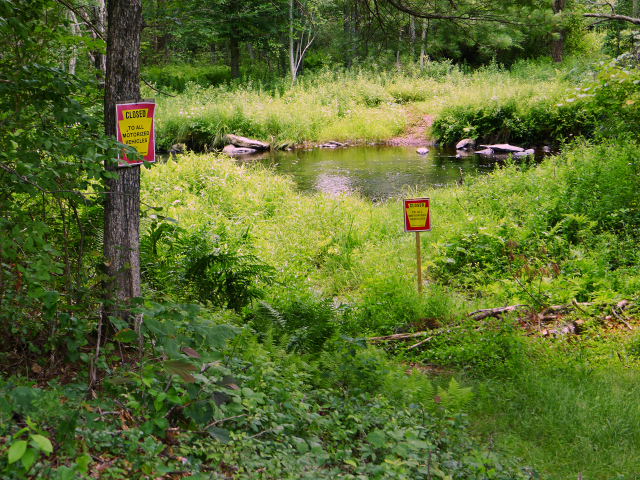
We did our best to ignore the bugs, and their buzzing and swooping eventually abated. Closing in on the creek, we passed a swampy area of the lake to our left, then the road dropped steeply down the hill. The creek was before us, and it was rushing like crazy, and there was no way across.
So that was the end of the hike.
Oh wait, it wasn’t! We had another three miles to walk back to the car. But on a beautiful sunny day, with a great partner by your side, any distance is too short.
And need I mention that we drove back through Waymart, arriving at the Waymart Hotel at 3:53pm, just in time for the 4:00pm opening of the barbecue pit? We stuffed ourselves with cheeseburgers (grilled, medium, onion and ketchup), fries, onion rings, and a half-pitcher of beer. And back at home, we collapsed on the bed and watched Stage 19 of the Tour de France—another fleeting pleasure of summer.
