Today was supposed to be another easy day, and it was … mostly. Our day started out with coffee and tea from The Independent, which we sipped while wandering around the farmers’ market in town. The market was packed as usual, but we found our way to the Sunset Acres tent (and bought some peach/cherry jam along the way too). We loaded up on goat cheese: the cranberry-orange-honey that I’d wished I bought last year, tomato-basil, plain, garlic-dill, and parisienne. We also bought a hunk of summer sausage from Smith Family Farm and a sourdough boule from Breadbox Bakery. If you can’t guess, we planned to bring the sausage, cheese and bread along for our snack on our hike, with the small box of wine that we bought at Hannaford-Bananaford a few nights ago.
While Rich was waiting in line for the bread, I overheard a girl talking to a park ranger [also in line] about the travesty of what happened to Jordan Pond House and how she won’t eat there now. The park ranger agreed—”unofficially.”


The hike of the day was chosen to be the Bowl Trail (or Beehive) to the Bowl, where we would sit and have our picnic, and then search for the set of steps the ranger told us about yesterday.
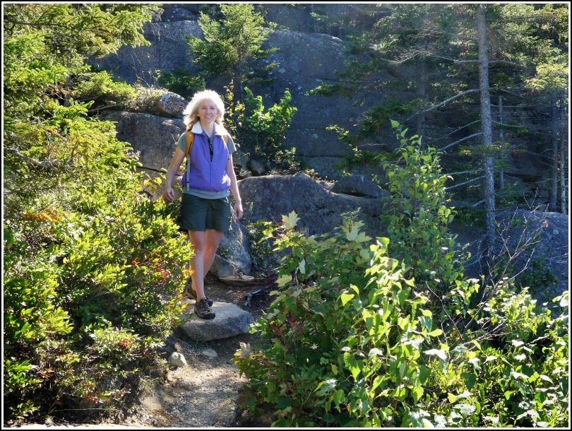
When we reached the intersection of the Bowl and Beehive Trails, I decided I wanted to take the Beehive up, and Rich would continue on the Bowl Trail and meet me at the Bowl. This worked out well; I missed the Beehive, having not hiked it for two years, and had an easy trek up, enjoying every rung and every view along the way.
We met at the Bowl, Rich taking my photo as I hopped down the path toward him, and then brought out the goodies. I should have been drinking water, but the pinot grigio tasted awesome after the climb and went especially well with the sausage, cheese and bread! We savored every crumb, talking about this and that and watching a tiny kelly-green inchworm make his way across the granite.
Then, it was our turn to make our way across the granite and the forest floor. We headed to the right around the Bowl until we couldn’t walk the shoreline any further and had to head into the woods. We saw nothing obvious but within a few yards, a high granite bluff appeared. We could also, at this point, see across to the hidden Enoch Mountain, which really did look like a miniature mountain from this perspective. We figured that if we could climb atop the bluff we might see the steps (or any steps) or some way up Enoch. We saw nothing other than the quite impressive bluff, which seems to be as high as the Beehive but is not named; it may just be considered part of the lower slopes of Champlain.
But wait … a cairn! We began seeing one cairn after another, not nice Bates-style cairns or anything else that looked official, but enough to tell us that another human had been here. We followed this series of cairns toward Enoch Mountain until the faint trail began dropping steeply and we decided to leave this exploration for another day, and simply try to find the steps.
We worked our way back to the Bowl and, following a chirping red squirrel, I headed into a black grove of dead pines. Maybe I was imagining a trail through their spiny arms, but I thought I detected something. Then I noticed a cairn at the edge of a dropoff. I looked below and it took a minute to comprehend what I was seeing, but I spotted the steps! Probably about 10-12 steps, half covered in pine debris, but very obviously constructed, not natural.
I called Rich over to see the discovery and we immediately went down, totally intrigued. Past the bottom of the steps, very little of a trail was evident, but we found enough cairns here and there to feel comfortable following them down a moderate hillside.
I could tell at this point that we probably weren’t heading toward Enoch; instead it looked like we were heading to the road, and wait-it seems that this trail is shown on the map in my GPS?! And it apparently does lead to the road. We followed it around little ledges and bluffs and through some open woods without any problems. We skirted to the south of a small marsh, and this is where we lost the trail, or at least it became nearly impassable as it led straight along a creekbed covered with impenetrable pine blowdowns. We tried skirting to the right—high ledges with no practical way to descend. We tried to the left—solid footing, but OH my god, a huge field of poison ivy.
We poked around in this general area for at least ten minutes before Rich led us farther to the north, entirely avoiding the whole crappy area, and we just bushwhacked our way to the Park Loop road, finding an orphan cairn along the way that made little sense, but again meant at least that someone had been here before. We also spotted a deer leaping through the woods at this point.
We were scratched up and itchy, but we made it! However, we still have no idea what trail or old road we found. It appears on USGS maps of the park as far back as 1942, and on some AMC maps that use the USGS topo as their basemap, but it doesn’t appear on any other park path maps we can find, nor is it mentioned in Pathmakers or Trails of History.
We hiked back down the road and arrived at Sand Beach in time to catch the bus. We had to take the long loop around, of course, and ended up in town just in time to get ready for dinner and get to Red Sky by 5:30.
As if yesterday’s feast wasn’t enough … we had a similarly awesome meal tonight at Red Sky. We started with the customary beers (Bar Harbor Real Ale for Rich and New Guy IPA for me) and appetizers (tomato tart for Rich and Deer Meadow mixed greens withe blue cheese, dried cranberries and balsamic vinaigrette for me). Our entrees were old favorites: Lobster risotto, including the meat of a whole lobster sauteed with sherry, mushrooms and asparagus for Rich, while I had the crabcakes made of fresh Peekytoe crab, pan-browned and served with roasted garlic aioli. Tonight we were way too stuffed for dessert!!!