Both hungry and in the mood for eggs, we began our day yet again at Jeannie’s. Rich ordered two fried eggs and I opted for two scrambled eggs. We each had toast (oatmeal for me, topped with Jeannie’s trademark rhubard spread and whole wheat for Rich). We shared an order of bacon and an order of homefries, and had coffee (for Rich) and cranberry juice (for me) to drink. The atmosphere was energetic as usual, and it really helped to brighten up a chilly, gloomy morning.
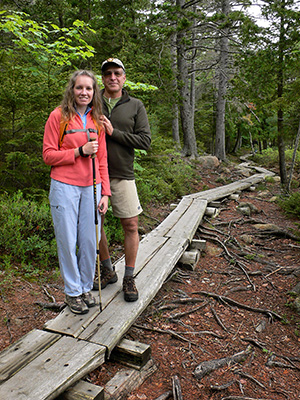
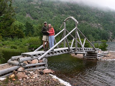
Even so, stepping back out into the chill after breakfast, we had very little motivation to do much of anything. After a few hours relaxing in our room, though, conditions started to improve, and we chose a hike around Jordan Pond as our main activity for the day. Although the Jordan Pond Trail is typically busy, it wasn’t too bad today, and there were plenty of peaceful stretches where we basically had the trail to ourselves. We had some ducklings as companions right at the beginning of our hike—probably because, due to the weather, it really was a day for ducks!
The skies began to clear as we rounded the eastern shore of the pond, finishing up our hike.
Then, still searching for some inspiration, we decided to drive around and recover a few of the boundary monuments we had already spotted from the road but hadn’t stopped to photograph.
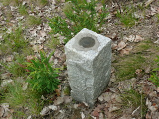
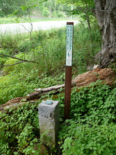
The first mark we recovered today was an NPS boundary marker, a disk with no designation stamped on it. We’re calling it #3 simply because it’s the third such disk we’ve found in Acadia. The marker is located on the western side of Otter Creek Road (Maine Route 3) along a boundary between park land and private land. The disk is set in the top of a granite post and its location is indicated by a nearby NPS witness post (these bright orange posts have helped us spot many of the boundary markers in the park while driving by)!
The second mark we documented today is another boundary marker we spotted while driving past. Like some of the other NPS boundary markers in Acadia, including the one we just found earlier today, it has no stamped designation, and we haven’t yet been able to find any information about it. This one is easy to spot if you look for the brown witness post along the east side of Otter Cliff Road about 0.7 miles south of its intersection with Route 3.
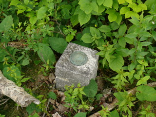
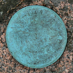
Like the first two, the third mark we documented today is an NPS disk with no stamped designation, so we gave it one of our own just for identification purposes on my website. Like some other boundary disks we’ve found, there are marks chiseled in this one indicating the property corner and directions of the boundary lines. This disk is set in a granite post on the eastern side of Otter Cliff Road. Although it is marked by an orange NPS witness post like many of the other boundary markers we’ve found here, this one is set back a bit from the road and is currently overgrown, making it a bit tougher to spot and to photograph.
And finally, we found a boundary marker that we’re calling JDR/PVT due to the stamping on the disk. We assume this indicated a boundary between private land and that of John D. Rockefeller, Jr., who among other contributions to the creation of the national park, donated many acres of land and built Acadia’s famous carriage road system. This disk is set in the top of a pink granite monument marked by an adjacent orange NPS witness post. The mark is set on a park boundary line on the eastern side of Otter Cliff Road.
Although today’s activities were pretty low-key, we still worked up an appetite, and ended up at Rosalie’s again. We had a half-plain, half-pepperoni pie. We followed it up with some treats from MDI Ice Cream: salted caramel ice cream for Rich, and lime-cucumber sorbet for me. I’d had my heart set on blueberry-basil, but they were out of it tonight. The lime-cucumber was a very refreshing alternative!
