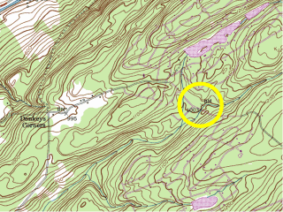
MUD
I’m not sure what possessed us to travel to the Delaware Water Gap NRA on this brutally cold December day, but we were intrigued by the triangulation station MUD and figured that searching for benchmarks would be a fine activity for the day.
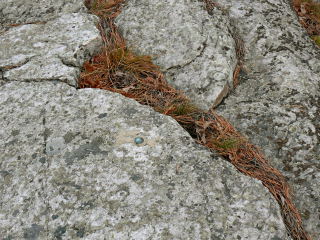
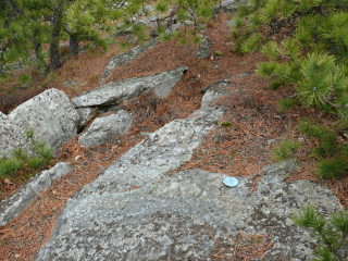
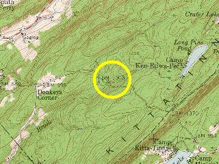
MUD is located on a high ridge reminiscent of the granite ridges we hike in Maine, complete with small pines and strong winds. We hiked from Skyline Drive along the Appalachian Trail and a gravel road remaining from a proposed subdivision (acquired by the federal government in the 1960s-1970s for the Tocks Island Dam project). Once up on the ridge, our GPSr led us directly to the station—or what remains of it.
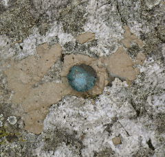
Both the original 1937 description and the recovery three years later specify that standard disks were used for the station and both reference marks. However, RM 2 was the only point we found marked by a disk. Broken-off disks leaving nothing but the shank and piece of the middle of the disk are nothing unusual, but what we found at the coordinates for both the station and RM 1 resembled bolts much more than damaged standard-sized disks. We are still not sure what to conclude. RM 2’s disk is also damaged, with a crack running through its upper left quadrant. Nevertheless, all three markers seem to be secure in their settings.
We agreed that on a warm day this could be a lovely spot for a picnic (despite the name of the station, we did not find any actual MUD here). But today was much too blustery, so after taking our photos and documenting our find we headed back to the car and onward with the rest of the day’s adventures.
X 30
We headed south and took a few moments to search for X 30 today, without any success. Like a geocacher who had searched the area before us, we noted an anomalous patch of gravel, but if the roads are in approximately the same location as when the mark was set, the gravel patch is too far from the roads’ centerlines to have been the correct spot. Still, it is worthy of investigation. On a warm, sunny day we would have spent hours here if necessary, measuring from the roads and thoroughly checking all the visible outcrops, but today was far too frigid and windy.
W 30
W 30 was our second roadside-benchmark bummer of the day. (These are supposed to be the easy ones!) The description seems straightforward enough, but just in case, Rich and I came armed not only with the datasheet but also with coordinates we’d pulled directly from our USGS topo map, which tend to be quite accurate in my experience. But once at the site, we became frustrated. The configuration of the road didn’t match the datasheet measurements, and try as we might, we could not understand how we could be simultaneously 35 feet NE of the centerline of the road, 35 feet NW of the stream, and anywhere near the coordinates. We searched the areas around both the datasheet coordinates and the map coordinates without finding any signs of a survey mark. The blazed trees and the reference post, of course, were nowhere to be found either. After a lengthy search we decided to move along to the next mark in the series.
Interestingly, a peek the next day at the historic topo maps on Maptech’s/Mytopo’s website gave us a partial answer. The road curves toward the northeast, coming very close to the benchmark, according to the 1954 map (surveyed in 1942, the same year the mark was set). But by 1992, the road has been straightened; the new route of the road shows in purple on the most recent topo map, indicating that it is a new revision made from aerial photos taken in 1971. The straightened road no longer passes within several yards of the benchmark coordinates.
This information only settles the discrepancy between the datasheet measurements and the layout of the area as we encountered it. We still might have been able to locate the benchmark somewhere in the area we searched. It’s possible that the entire area has changed dramatically and the mark may be deeply buried or even gone. If we’re in the area again on a warmer, more pleasant day, we may attempt to search once more.
V 30
Rich and I think we’ve located the outcropping boulder in which V 30 was set, but we have not yet found the disk or any evidence of it. Though the farmhouse and garage mentioned in the description are now gone, it wasn’t difficult to determine where they once stood, and the rock fence still exists. The outcropping boulder we found alongside the road fits the description and all measurements check out, to the best of our knowledge.
At first glance, the boulder appears to be of very poor quality and we initially rejected it as our target, but we then discovered that the rock is splintering only because tree roots have inched their way under and through it—a situation that very likely was not the case when this mark was set. In 1942, the boulder easily could have been solid and stable. The disk itself may be hidden beneath some of the soil and moss that we haven’t yet removed, or it may have been set into a portion of the boulder that has since broken off. A search of the area yielded nothing else as a possibility, but we intend to spend more time searching (and examining the likely boulder) on a warmer day.
U 30
Finally, some luck for our last mark of the day! After unsuccessful searches for three other marks in the “30″ series along the Flatbrookville-Stillwater Road (LY0756, LY0757, LY0758) we were losing hope, but W 30 was still in place and was easy to find. We pulled into the driveway of the old farm house (now the Delaware View House General Store) and could see the mark’s concrete monument immediately, as it projects several inches. The disk is in excellent condition. Orange tape encircles the monument, so the mark may have been in use quite recently.
If the day had been warmer and less windy, we would have stayed longer to explore the grounds and enjoy the beautiful view from the old farmhouse. As it was, we hurried back to the car after taking our photos and measurements. This would be another lovely picnic spot … in May!
