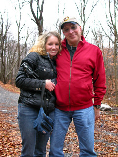
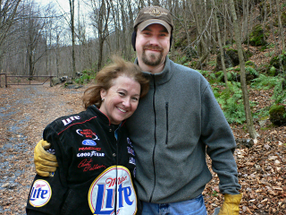
Rich and I spent a few hours on this breezy, flurrying morning searching for “Hmmm…” with Hound (of fox-and-the-hound) and his mother, but we had no luck and eventually decided to give up on the hunt. We were cold, and we had more exciting plans for the day anyway … searching for two NY/PA boundary markers!
After a leisurely drive up Route 171 and a stop to investigate the Inn at Starlight Lake, we were on our way toward the boundary monument. Nearing the mark, we both sensed that we’d been in this spot before, though it wasn’t till we got home and did some research that we discovered that we’d driven right past the parking area for “Walk to the Lake,” a (now-archived) cache that we both found back in May 2002. [In fact, I believe it was the first time I beat Rich to a First Find!] The boundary monument is only about a mile from that cache, at a high spot along the river that would probably be lovely in Summer but was bare and colorless in December.
The stone boundary monument itself was no challenge to find, as it’s about six feet high and just a few yards south of the road. RM 3 was partially covered by dirt and debris, but we were able to zero in on it quickly from clues in the description. Our toughest challenge was finding RM 1. The description of the rock into which it’s set is misleading (probably incorrect), with the boulder described as being 1.0 ft, largest dimension. We suspected an error immediately, because the rock is also described as having a height of about 4.0 ft. Multiple times we searched the prominent outcrops of rock in the target area, and finally found RM 1 beneath a thick mat of moss and soil on an outcrop approximately 10 feet long. The error in the description may have been a simple misplacing of the decimal point.
Next, we moved on to search for another boundary monument, a granite post, nearby. We were intrigued by the possibility of finding a potentially “ancient” mark, as marks go; the boundary was surveyed in the late 1700s, so we felt there was just the slightest chance the granite post might have dated from that time. (The station disk, reference and azimuth marks were monumented in 1940, as described on the datasheet, but the granite post was already in place.) Unfortunately, though, we were unable to find any kind of a post in the area. It should have been easy to spot, especially if it still projects 15 inches. The coordinates are close to a road, however, and this very visibility may have led to the mark’s disappearance, if it is in fact gone.
Our final find for the day was an unexpected one: a PDH disk on a bridge. We took Vinegar Hill Road from the New York border toward Lanesboro, and while waiting to turn onto Main Street, Rich happened to glance at the old concrete bridge to his right. He saw something colorful, and I got out to check. I wasn’t too surprised to see one of the typical aqua-colored, unstamped PDH disks that I’ve found on so many similar bridges. Though the cold was fierce, we managed to take a few photos and document the coordinates. This little discovery was a satisfying end to a very adventurous day!
Today's Geocache
Hmmmm…
- Owner: whistler & co.
-
Location: N 41° 34.811' W 075° 28.719'

- Log Type: Didn't find it
- Date: 2 December 2006
- Original Geocaching.com listing
Hi, W & Co.!
Believe it or not, Rich and I haven’t gone Geocaching since January. Just too many other interesting activities vying for our time and attention. What, then, drew us to search for this cache? Well, it was really just a coincidental combination of two things: having discovered the “source” of the coordinates very early on and hoping to have a chance to see what the fuss was about … and the fact that we were planning on heading in this very direction this weekend anyway to search for some boundary monuments along the PA/NY border.
For some reason (probably not tree cover this time of year!) signal reception was very spotty when we first began searching. We found ourselves following that arrow along some nice trails which led to interesting ruins, but soon our geo-intuition was warning us that we were probably searching a little “higher” than we should have been. Our GPSr soon agreed with us, so down we went. Another surprise awaited near the gate—turned out to be Hound of fox-and-the-hound and his Mom up from Texas.
The next hour or so was spent chatting and searching. We know our coordinates were correct, but the four of us just weren’t able to come up with the cache. As we’ve now seen from later logs we must have been right on top of it, but frankly I was getting cold and we still had a few hours of survey mark hunting ahead of us. Better luck to us next time! Perhaps we’ll return to this area for squirrel hunting and take another peek for the cache in the near future.
Thanks for an interesting challenge and the chance to meet some famous local cachers!
Zhanna
When you have correctly solved for the source of the coordinates, you will know it! Zhanna and I have seen this method before. But, for us, there was more to it.
At the site this morning, three GPS units kept bringing us all back to the same spot (within roughly a 10-15 foot radius) in spite of some very spotty signal reception. Upon our arrival around 9:45am, Zhanna and I initially found ourselves being led from the gated road toward the top of the hill, where we found some fascinating ruins of abutments and other unknown man-made features. We saw a couple of trails leading to this area so it struck us as being a very likely cache location, even for a 1½-star terrain rating. As a matter of fact, we thought it was/is a great idea to bring someone up here for a bit of a history lesson about the place. I’m still wondering what sort of industrial activities were carried out here! We shortly came to realize, however, that the right location was somewhere down below, where our searching had begun only moments ago.
As we made our way downhill we observed the arrival of two other cachers. We didn’t want to disturb their search efforts at first, but as we approached we conducted the usual cachers’ introductions and discovered, much to our surprise, that this was none other than Chris (the “hound” part of The Fox and Hound team) and his visiting mom from Texas. A pleasure to meet both of you! We exchanged our thoughts about the cache and the location, and then casually joined each other in a more thorough search of the area. Unfortunately, our combined “ground zero” had us in an area that seemed more like a needle-in-a-haystack type of situation for a micro-sized container! There were none of the typical “uniquely obvious” hiding spots we were expecting, except for one that we checked quite carefully (or as much as we dared, considering the unsightly matter contained in a part of it!). This item was a bit off from the coordinates. Even now, though, we are still not sure if we were looking in the correct area, despite our faith in the given coordinates. This one really has us buffaloed!!! Hmmmm… I wouldn’t mind going back for another close look. But on a warmer day, of course!!! ![]()
~Rich in NEPA~

