I’m writing this from the future: April 2, 2023. Last night, while watching an episode of “The Curse of Oak Island” that featured wide stone walls. Rich paused the video, turned to me, and asked “Wasn’t there a hike we did where we were walking between these very wide, high stone walls?” I had had a similar vague memory, but didn’t recall enough of it to even mention it.
This simple question led to an evening of investigation into my notes, our photos and tracklogs, and eventally archived email messages. A message I had sent to the geocacher “Papadadio” in June 2006 was enough to help us crack the case.
We finally figured out that the place with the wide stone walls was the Indian Hill loop trail in Sterling Forest State Park, which we hiked on May 29, 2006. That same message mentioned a hike we did the following day, to Black Mountain in Harriman State Park.
From there, Rich and I were determined to figure out just what happened on that rainy day when we got a bit lost at Rockefeller State Park Preserve—another day-hike for which I had very sparse notes and we had almost no photos. What follows is what we were able to piece together from the notes, email messages, and other clues we were able to find.
We’ve been having so much fun lately choosing hikes from “50 Hikes in the Lower Hudson Valley” and spending our days off exploring new areas. Today, however, began with cloudy conditions that threatened rain, and made it very difficult to get motivated to travel anywhere. After several emails back and forth, Rich and I finally decided to take a drive to the east side of the Hudson River and explore the Rockefeller State Park Preserve.
This was attractive to us for a few reasons: the park features wide-open carriage roads which would be pleasant enough to walk even in moderate rain (with proper gear), and it just so happens that these carriage roads were built by John D. Rockefeller, who built the very similar carriage roads that we love in Acadia. The Preserve even features a “13 Bridges Loop” evocative of Acadia’s “Seven Bridges” section of carriage roads near Aunt Betty Pond.
Following the hike outlined in the “50 Hikes” book, we parked at the parking area just off Route 117, and went through the tollbooth onto the trails. We followed the Old Sleepy Hollow Road Trail southwest from the parking area until we reached the turnoff for the Eagle Hill Loop. This is a short jaunt up and around a small knoll. We stopped here at a large boulder to share a snack (“cheese curls!!!”) and this is where the warm misty conditions suddenly turned to pouring rain. We decided that we might as well continue on our planned route. It was warm, and as long as we could stay warm and relatively dry, we figured the walk would be pleasant enough.
Once back on the trail from our detour to Eagle Hill, we crossed the highway and wandered north along the Thirteen Bridges trail. It loops up to the north and then back south again, the thirteen bridges crossing Gory Brook as the trail (carriage road) passes back and forth over the brook on the second half of this loop.
We passed beneath Route 117 and turned onto the Witch’s Spring Trail. We made another quick detour to Spook Rock (how could you not?!) and found it to be a large, flat-topped boulder that would be a perfect snack or picnic spot on a dry day. Today, everything was just too soggy, and we preferred to keep moving.
We returned to the Witch’s Spring Trail and continued south. Somewhere here, after the bridge just south of this trail, is where we got mixed up. Even the trail guide indicates that the signage in this area is poor, although we weren’t following the guide turn by turn because we didn’t want to keep it out in the rain. The best we could figure was that one of the trails/carriage roads continued south but was actually part of a different property and therefore not on the map we had, which was showing only the Preserve property. It took a little while to discover that we were definitely not headed in the right direction. To top it off, we were wandering around on the exposed carriage roads, not knowing where we were and not really able to consult the book, during the worst part of the rain.
At some point we came across a man and woman who got us headed in the right direction. We followed a winding trail downhill across a field (which we later discovered was the Douglas Hill Trail) to an underpass at Sleepy Hollow Road. We could have followed the road back toward the parking area, but instead we chose to get back on the trails and take the Canter Alley Trail north to join up again with the Pocantico River Trail (which is where we should have ended up right after Witch’s Spring, if we had taken the right turns). This trail took us back to the Old Sleepy Hollow Trail, where we retraced our steps from earlier in the day back to the car.
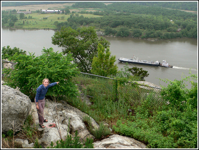
In spite of the mixup and the rain, we both had a wonderful, fun, cozy day. After drying off, we treated ourselves to a delicious Mexican supper of flautas, steak, and flaming pears(!) at Guadalajara Restaurant in Sleepy Hollow. We even found an unexpected benchmark at an overlook on our way home.
Unfortunately, we didn’t take any photos today due to the rainy conditions, other than a few at the overlook where we found the benchmark. Rich’s pack got soaked through, too, and the hiking guide got wet (but was salvageable!). Our tracklog only contains the second part of our hike: I wasn’t routinely recording tracklogs at that time, and I must have turned on the GPS only once we realized we didn’t know where we were.