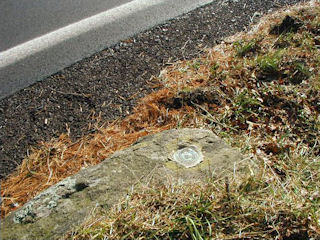
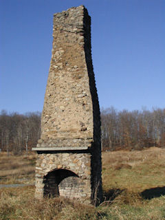
On this chilly Sunday, Rich and I decided to continue our search for marks in the 235 series in Pike County. M 235 was our first stop. Though the historic description of this mark contained some inaccuracies, the mark was still easy to find.
X 235 sounded like an easy one, but we searched the area twice and were unable to find the mark. We followed the to-reach directions to the letter, ending up at a high-tension power line crossing. We took the indicated measurements from the road and from the power line right-of-way. No large boulder matching the description was found.
Next we traveled north along Decker Hollow Road to Kimbles to continue our search for the 235 series marks. This mark required no searching. As described, it’s set in the northwest wingwall of the north abutment of a concrete bridge along T495, less than 200 feet south-southeast of the intersection of Decker Hollow Road and T495.
PTS 22 was to our final mark for the day, after locating LY1235 nearby, and was a very interesting one. Continuing along T495, a narrow lane skirting the ridge above the tracks and the Lackawaxen River, we looked for a good place to climb down toward this mark. The presence of rocky cliffs all along the distance we traveled was not encouraging, so we backtracked and parked in an empty lot just beyond the bridge over the railroad tracks, and walked southeast along the tracks toward the mark.
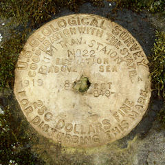
It was easy to spot the bright yellow disk from a distance. It’s set vertically into a ledge just south of the Lackawaxen and Stourbridge Railroad tracks. The disk has a few unusual characteristics. There’s a small hole through the center, though the disk doesn’t appear to have been disturbed or otherwise damaged.
In addition, the stamping appears to have been done with only a set of number stamps. Close inspection reveals that the letters stamped on the disk are actually constructed from the number “1” (and “0” where appropriate). It appears to have taken a bit of work to stamp the letters (and apparently they accidentally omitted the second “T” in STATION). I have to wonder just what happened on that day in 1919.
Today's Geocache
Fly Like an Eagle
- Owner: 4FUN & Dog
- Location: N 41° 28.194' W 075° 06.550'
- Log Type: Found it
- Date: 30 November 2003
- Original Geocaching.com listing
Hi, 4F&D!
I was in the area today hunting benchmarks with Rich in NEPA. After several successful—and several unsuccessful—recoveries, he suggested we take a drive along the river so that I could finally do this cache. Luckily he still had the coordinates in his GPSr, and I was able to navigate here without a problem. Funny, I’d just commented on a similar sign nearby! There were no eagles or nests to be seen, but this is still a lovely place to watch the river. Too bad it was such a chilly day or we would’ve spent more time hanging out here, snacking on pizza and pies as usual. Thanks!
Zhanna
(Logged on May 23, 2003)
Howdy, 4F&D! I’ll bet you can’t believe it took me so long to get here. Well, honestly I was contemplating doing a biking trip along the Lackawaxen to the Roebling viaduct once Spring and nicer weather arrived. I’m still waiting for the nicer weather! This morning was cloudy, cool, damp and breezy. I’d just completed the nearby “Space Oddity” cache so naturally I couldn’t pass up this one. Found the little pull-off without a problem and was prepared with binoculars and long-lens digital camera for capturing some bald eagles. Unfortunately, the eagles were very shy and uncooperative. I spent close to an hour and a half sitting along the river bank and at two other pull-offs but not a single eagle was to be seen. There were lots of noisy crows, though! Anyway, it was just so nice hanging out here snacking on a Tastykake lemon pie, with the river all to myself. Thanks for the fun! A verification photo has been e-mailed. ~Rich in NEPA~


