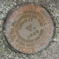
Out on our mountain bikes today, we took an easy ride up to Summit Hill from Jim Thorpe on the hunt for triangulation station SUMMIT. We found the cemetery mentioned in the description easily enough, but then the trouble started.
The road running along the north edge of the cemetery—now named Treeline Drive—is undergoing construction and adjoining plots have been surveyed. The area is apparently experiencing some development. We searched several probable access points along Treeline Drive, but no trace of the woods road leading north to the station could be found. The entire area is thickly overgrown with some variety of towering weeds.
We did find a small opening to an ATV track cutting back through the weeds, so we followed that through the weeds and the woods to the bottom of a steep slope, and this was as far as we felt comfortable bringing the bikes. Using hands as well as feet, we began to climb.
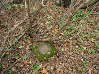
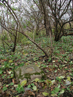
Once we reached the top of the bluff—no small feat as it was extremely steep and slippery and densely littered with old broken glass bottles—we found all the marks in a matter of minutes. Each mark was well exposed when we arrived and was visible from several yards away. The marks are all in excellent condition, and it didn’t take us long to finish our photographs and notes.
Afterward we picked our way back down the treacherous slope and grabbed our bikes, and then headed back south on the ATV trail toward the cemetery. Our plans to search out some of the old landmark stations in Summit Hill were rained out by a very sudden, very fierce storm which convinced us to fly back down Route 902 toward our vehicle. We arrived hilariously drenched and coated in black mud, most of which we washed off in the creek before seeking warm refuge in Rich’s car.
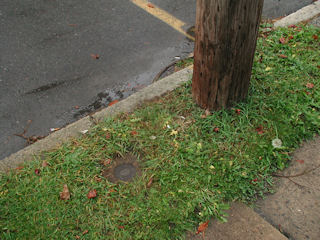
The rain, of course, stopped soon afterward and after a quick snack of candy corn, we were ready to search for the azimuth mark. We parked at the intersection of North Pine Street and North Lehigh Street and then walked east to the mark. Note: there is some confusion as to the actual route of Route 902. Some maps indicate that it travels north-south not on North Pine Street but two blocks west, on North Chestnut. Our recollection is that Route 902 follows North Pine Street, but we will confirm this the next time we visit the area.


