Since almost a year ago, when we found the first cross, we’ve been looking forward to the search for the three remaining carved crosses on Cadillac Mountain that served as the property corners for the Brewer property in the early 1900s (and probably others before then).
At some point last fall we discovered online a collection of transcribed deeds for MDI, most importantly the one for the Peters Plan, that outlined the boundaries for transferred deeds. The locations of the remaining crosses were described among the deeds. We had to sit on this exciting information for almost a year, but last night over pizza we decided that searching for the crosses would be our first activity for this year’s trip.
Beginning at a point in the Gilmore-Brewer division line or Deane line, so-called, said point being on the northern slope of the mountain [Green in 1908; Cadillac today] and about 250 feet easterly of the mountain road, and is marked by an iron bolt set in the ledge, and a cross cut in the ledge; then running S 12° 30′ E 2105 feet to an iron bolt set in the ledge near the edge of a steep bluff on the southerly slope of the mountain, and is also marked by a cross cut in the ledge; then S 67° 30′ W 2589 feet to an iron bolt set in the ledge on the westerly slope of the western ridge of the mountain, and is also marked by a cross cut in the ledge; then N 49° 30′ W 660 feet to an iron bolt set in the ledge and a cross cut in the ledge near said bolt, said point being in the Deane line; then following said Deane line, N 42° E 3422 feet to the place of beginning.
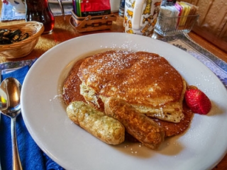
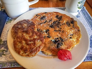
Breakfast at the Black Friar was delicious and cozy as usual. Under the same ownership as last year, the pub has a similar but expanded menu (including a special this week of venison burgers, which Rich is very much looking forward to trying). Breakfast for both of us today consisted of pancakes and sausage: blueberry and regular sausage patties for me, buttermilk and four-pepper chicken sausage for Rich.
There were only two other tables occupied when we came in and the people were mostly quiet. We commented to the owner how nice it was that the derelict building that had been in front of the Black Friar has been torn down. He said that he and his wife own the lot and it is for sale for a million dollars if we’re interested. Hmm, not sure.
A quick stop at Hannaford was all we needed to do on the way back to our room. Then we prepared for our hike and headed to Cadillac summit.
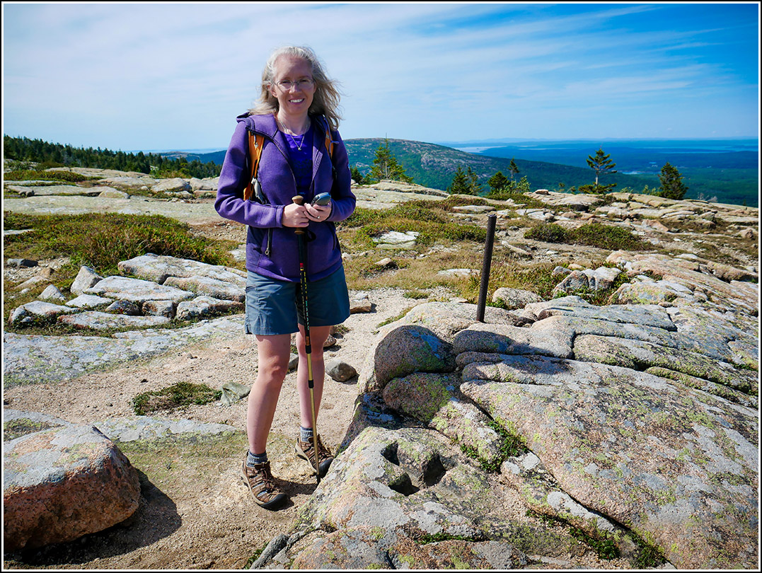
At the summit it was the typical summer situation: cars and people everywhere, Oli’s Trolleys lined up on the east side of the loop. Strangely we did not see many coach buses. (I just learned that most of the cruise ships for today and tomorrow have been canceled due to the hurricane, so maybe that has something to do with it?) Nevertheless, once we got off the trail, as usual, we had the mountain to ourselves.
We first decided to look for the cross that has been described by a local acquaintance as being in a very precarious position. It was the closest to the parking area and is only a hundred feet or so from the paved loop path that all the tourists take. We got as close as we could on the path and then headed down the quite steep slope toward the coordinates I had pulled from the deed.
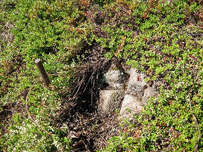
It was slightly tricky, but there were plenty of flat places to walk and footholds, and plenty of rocks and shrubbery for handholds. Neither of us felt too scared as long as we didn’t look down! The slope did drop off precipitously just past the cross. We spotted the bolt first, as we expected to, and then worked our way over to it. The cross was a few inches from the bolt, carved into a laurel-covered ledge. I pulled the thick and wiry laurel aside enough to take some photos of the cross.
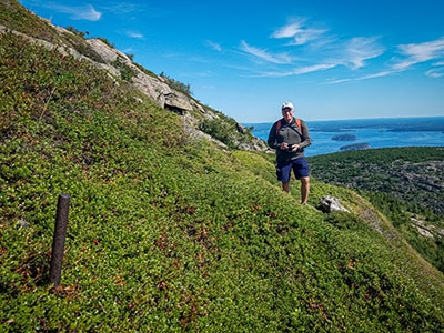
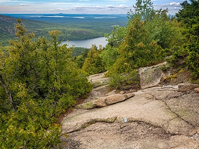
A quick steep traverse put us back onto the paved path, which we followed as it made the loop back around, and then we followed the road over to the trailhead for the North Ridge trail. Along this trail we expected to find the next cross. And we did, about a quarter mile down the trail. This was the easiest to see and access by far because the trail goes right past it. There was no way you could miss it!
And finally, we crossed back over toward the gift shop, passing by Oli’s Trolleys lined up along the circle. And we headed down the South Ridge trail just like last year, but this year we intended to go further down the super steep (sometimes treacherous) West Face Trail.
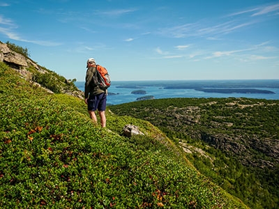
Along the way we did, of course, take a quick look to make sure we could spot the carved cross we found last year, and we did. We continued on down, inching (and I do mean inching!) closer to the coordinates we had determined ahead of time. At one point we were 185 feet away and I spotted what looked like a faint path up into relatively (for this area) open woods.
We decided to continue on, though, because it looked like the official trail might have taken us closer than we currently were. It’s generally better to walk the trail as long as you can rather than bushwhack immediately. Well, the trail took us a little closer, and then we decided to veer off a bit and went up a very steep (but nice and dry) slope: easy slab climbing as long as it’s dry, which it was. I got within 27 feet and thought for sure this was it, but believe it or not we simply could not see anything through the extremely thick growth, nor did we see any way to get through it.
I attempted to enter the area from a few different directions and it was just brutal. It felt so defeating to be within a few yards and still not be able to see or reach the mark! We climbed even higher and thought we might be able to reach it from above, but no such luck.
After long deliberation, we decided that I would go back to the faint path I thought I had seen about 185 feet from the coordinates. I did this very carefully, and found it to be relatively easy walking. It did even appear that someone else might have been walking around in here, but still, I was able to reach a point 30 feet away and then was stopped by the same seemingly impenetrable brush! WTF?! I tried coming at it from the bottom, top and side and still no luck.
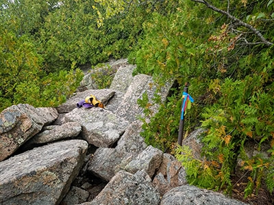
Eventually I peered through the dry pines far enough and at just the right angle that I finally spotted the bolt! And it had flagging tape tied around the top. Again, WTF? Who has been here and why? The tape looked new; it was still supple rather than brittle and it wasn’t at all faded. So bizarre.
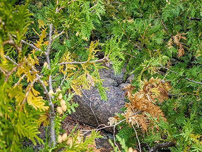
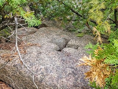
Well, at least now I knew where I had to go, so I just forced my way through and popped out onto not a ledge, but a pile of talus/boulders. Again, not at all what I was expecting. And I reached the bolt … but … where was the cross? I looked all around and didn’t see it. Because all of the other bolts were within a foot or so of the cross, I had a bad feeling that the cross might have been at the foot of the bolt and had been covered at some point by falling or sliding talus. Ugh.
By this point Rich had spotted me through the trees and he was trying very hard, ultimately in vain, to reach me. It was so thick in there! I took a few more minutes to poke around, and for some reason I thought I would check a sloping boulder/ledge that I noticed a few yards away from the bolt. It was overhung with branches but through them I spotted something on the rock. Pushing them aside revealed the damned cross!!! So awesome. I just feel bummed that Rich wasn’t able to see it as well.
I worked my way out to where he had come down the steep slope by this point (in retrospect this would have been the best, if there was a best, way into there, and I’m sure I would have forced my way through if I’d seen the taped bolt, but I hadn’t). Exhausted and thirsty by this point, we picked our way back down to the West Face Trail, and then back up to the South Ridge, stopping here and there for a drink and snack of fruit slices. We cheated a bit and popped out onto the road at the point where it comes nearest to the South Ridge Trail, just below the Blue Hill Overlook. We couldn’t take much more climbing over rocks today!
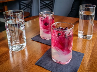
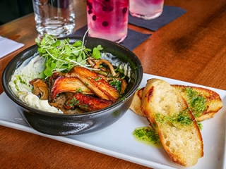
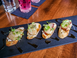
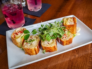
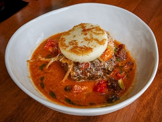
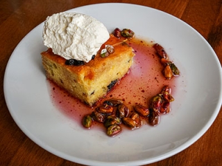
Supper was back in town at Ciao, the new endeavor by the owners of the previous Mache Bistro, which was one of our favorites. This restaurant was fantastic too, with similar flavors on the menu but a slightly different concept. All menu items are small plates and we ordered four to share, along with a blueberry lemonade vodka cocktail. As a bonus, we had the entire place to ourselves until the end of our meal. We were impressed by the whole experience. We finished off our meal with a dessert of olive oil cake, and then some wine back at the room on this very chilly evening, with dampness in the air due to the pending storm.