Today was a very exciting day full of explorations! It began with a sad morning, though, because we said goodbye to Dad who is on his way back to New Hampshire and eventually Pennsylvania. We ate breakfast at the Black Friar, where we all enjoyed some version of their pancakes (plain for Rich, blueberry for me, and blueberry with the full breakfast for Dad). Rich and Dad also had bacon (“farm bacon, might not crisp up” warned the proprietor). Warmed our butter underneath my teapot and it worked pretty well.
Carved cross on Cadillac Mountain
It was so foggy this morning that a walk on the shore path wouldn’t have offered any views, so we skipped that traditional last-day stroll and went back to our rooms, where Dad got ready to head out. I think it was around 9:45am when he left. Rich and I headed to Cadillac Mountain shortly afterward to begin our explorations!
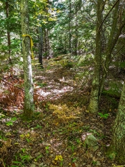
Our goal was to look for one of several carved crosses on Cadillac Mountain. I first learned about crosses from an entry in Pathmakers. Note this part of the description for Cadillac West Face Trail (#32):
At eastern end [of the West Face Trail], a 22" x 1.5" steel pin marks a Greek Cross, 12" x 13" x 2.5" deep, carved into the ledge and is one of three on Cadillac Mountain.
So not only does it mention the cross along the West Face Trail, but also alludes to two other such crosses on Cadillac Mountain—but nowhere in the book does it ever say anything else about the other crosses or where they were. You can imagine how this had us going crazy!
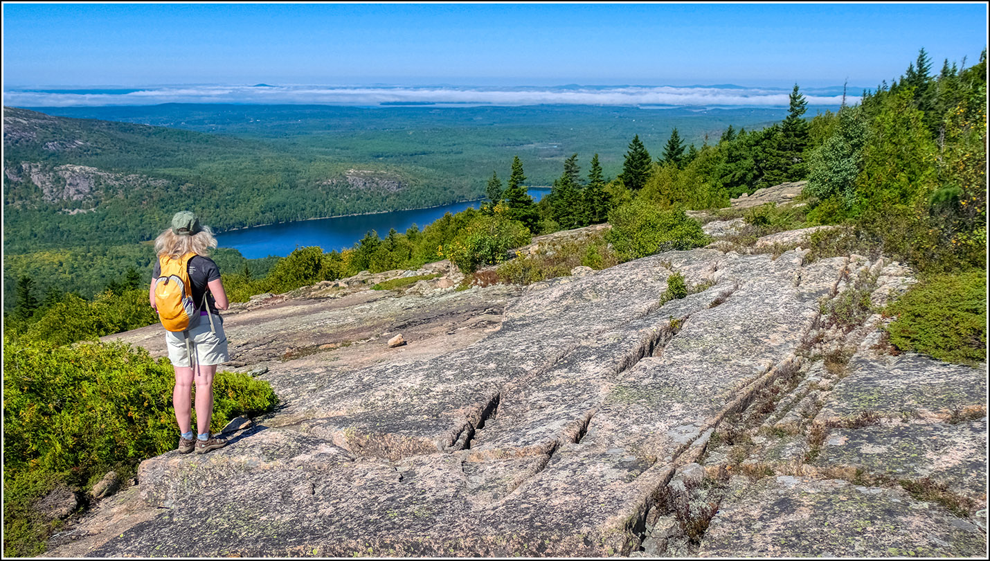
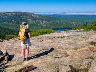
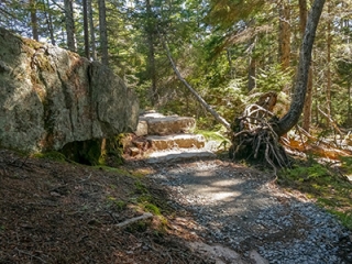
Cadillac wasn’t too busy this morning. I assume a lot of people got a later start than usual because of the morning fog. We began hiking along the South Ridge Trail on our way to its intersection with the West Face Trail (our goal being, of course, the carved Greek Cross with a steel pin that is supposedly near the intersection of those two trails).
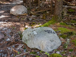
We weren’t intending to hike the West Face—a pretty brutal and treacherous trail in spots; the 0.4 miles of the South Ridge that we needed to hike to get there would be enough! By now the sun was out and it was hot. We stopped along our way to check on the tri-station MOUNT DESERT RESET, its reference marks, and K 24, a USGS mark that was referred to in the description for MOUNT DESERT RESET. We also noted a strange bolt (not the same one I referred to in my recovery note) that will require more investigation. The original survey notes from MaineDOT surveyor Harry Nelson will be a good starting point.
We took a slow walk toward the trailhead for the West Face Trail. Although the South Ridge is the easiest (currently published) route up Cadillac, it’s still pretty rugged near the summit. There are some big boulders to step over and hoist yourself up on, one iron rung, and some stone steps. We had no idea where to look for the cross; was it right at the intersection and if so, why had we not noticed it in the past?
My GPSr has a topo basemap and it shows the West Face trail intersection slightly (200 ft.?) north of where it currently is. We’re not sure if it’s just slightly off or if the trail was rerouted at some point, but our plan was to check the current intersection and then widen our search to the other coordinates (and check all around the ledges in that area) if necessary.
We found nothing at the current trail intersection, so Rich took a few photos and I headed down the West Face Trail to the point where it started to become steep and the ledges narrowed in a bit. I figured the cross wouldn’t be down that far, or at least it wouldn’t be a likely spot for it.
While I was poking around there, Rich walked up toward the coordinates from the GPSr. I was searching around in the other direction when I came over the ledge and he spotted me. He waved his hiking pole and said “hey!” As I walked toward him I asked if he found it. “Yes,” he said “I found it!” I was beyond excited! I can’t believe it, I kept saying!
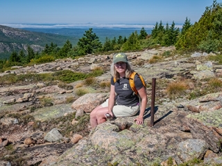
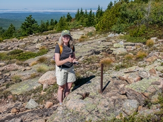
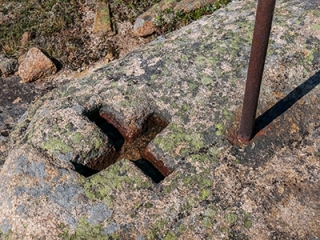
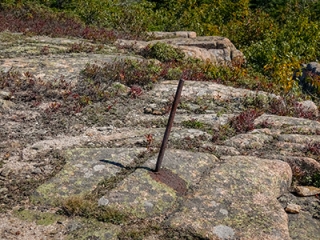
He won’t take credit for it, saying that I was the one who picked the coordinates off the map but to me, he’s the one who spotted it from a distance! The cross itself is pretty neat, well defined and deeply carved. Quite different from a chiseled cross survey mark, but I do wonder if it was for some kind of survey. I don’t know what else it could have been for. I have no idea when it was carved. Without any information to go on, we weren’t able to search for the remaining crosses, but we have a whole year to research them! By now the sun was very intense, and although the air temperature was only in the low 70s it felt HOT. We climbed slowly back up to the summit and drank plenty of water once we returned to the car.
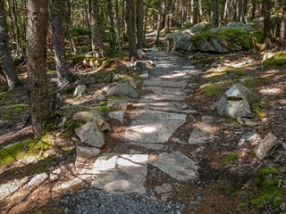
Otter Cove Path
Our next stop after a pleasant drive down the mountain was along Otter Cliff Road. We wanted to check out the trail we both spotted while we were riding the Island Explorer the other day. Could it have been the old Yellow & White Trail?
There isn’t a safe place to stop nearby on Otter Cliff Road, so Rich turned onto Fish House Road, the little road that goes under the low overpass and then dead-ends at the eastern shore of Otter Cove. This would be a good picnic spot on a quiet day on the island (not today! Spectacular weather on a Saturday means that the park and the entire island were packed).
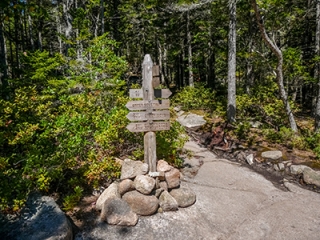
Rich waited with the car at the intersection while I took a quick run to check out the trail. It was clear within a few seconds that this well established path was definitely not the old Yellow & White. I assumed it was one of the relatively new Otter Creek/Blackwoods connector paths, but I didn’t know for sure until I reached the other end and saw the name (Otter Cove Path) on a signpost at the intersection with the Gorham Mountain Trail.
I didn’t want to leave Rich for too long wondering where I might have gone, so I gave myself only about 15 minutes to explore the trail. I had noted that the old Black Path should have passed somewhere near this area. I did find one cairn well enough off the Otter Cove Path to convince me it might indicate another trail, but I didn’t have the chance today to explore it further, and I didn’t see any other cairns nearby to confirm that idea.
Searching for the Green & Black Trail
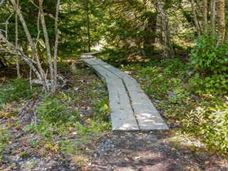
Our next adventure was to check out the path we thought we had seen from Route 3 in the vicinity of the old Green & Black path. We found the spot again immediately, but as soon as I got out of the car I could see that it was drainage and not a trail. I poked around closer to the ledges at the intersection of Otter Cliff and Otter Creek Roads and hopped up onto a scrub-covered ridge to see if I could spot anything. I pushed my way through the brush, at first finding no indication that anyone had been there. But a few yards into the woods I spotted an obvious foot trail and yellow flagging tape tied to a tree! Whee!!! I had found something!
I’m still not sure exactly what I found. I followed cairns and yellow flagging for a while, struggling in the thick woods and heat and humidity. The path was almost impossible to spot in most areas. I was just following yellow tape and occasional cairns.
When I looked at my tracklog later and compared it to the Pathmakers map, I could see that it started off matching the route of the Green & Black, but then the path I was following headed more northerly while the Green & Black headed southeast (and should, to eventually end at The Bowl). So was the person marking the trail just going around some obstacle, or was he too trying to find the way and leaving tape so he could make his way out of there?! I noticed that the flagging was tied high in the trees and it was quite hard to see on the way up. On the way down, though, the flags were basically at eye level and very easy to spot. Was this intentional?
I fought my way back out, saving the rest of the exploration for another cooler day with long pants and gaiters. I’ll try heading a bit south just before the final flagging tape waypoint and see if I can get out on the ledge I see in the satellite view that should head me in the right direction. Beginning from The Bowl might also be a way to locate the Green & Black Trail.
Back at the car, we had one more adventure planned: two benchmark hunts. The first was a long shot; the last surveyor to look for it in 2016 had no luck and did a lot of checking from various points with equipment we don’t have. He couldn’t find it, so I doubted we could. No luck. We did locate the right spot (the pole numbers matched) but the only ledge that might be a foot above the highway was covered with moss so thick there was no way to get through it. The other thing that looked like a ledge was a pile of asphalt as described by the surveyor.
On to the next mark which we had looked for years ago. No luck back then, but now we had the surveyor’s coordinates to use, and they took us right to the mark. Wow, was it buried, though!


We enjoyed an excellent dinner at Rogue Café and then a magical drive back through the park after dark. A red fox and a buck crossed our path along the road. We spent a few minutes in the dark listening to the rumbling sea at Thunder Hole!
