Last night we agreed that we would plan something a little simpler for today. What appealed to us most was checking out the old abandoned Boyd Road near Hunters Brook, and then searching, once again, for the USGS survey marker K 19 that had thus far eluded us.
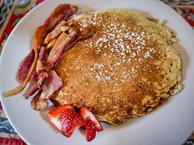
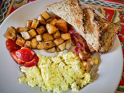
As expected, we were feeling a little sluggish this morning, and our day began a little later than usual with breakfast at the Black Friar. Our appetites were awake, though. Rich managed to finish three buttermilk pancakes with bacon, and I somehow ate a large platter of scrambled eggs, toast, home fries, and bacon. Everything was very good! We took a leisurely walk back to our room to gather our hiking gear, and headed out soon afterward.
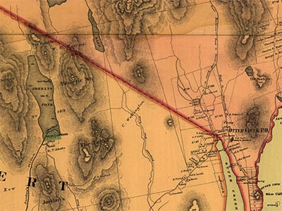
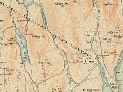
I haven’t been able to find out very much about the Boyd Road. According to Pathmakers, it was an “early cart road in the former Seal Harbor VIS Path District,” is a “2.4 mile-road still evident but not marked,” and its name was “likely attributed to R. Boyd who lived in the area in the 1880s.” The book also mentions that the road was “shown on 1881 and 1888 island maps and on 1893 Rand map.”
I wasn’t able to find an 1881 map of the island, but an 1887 map labels the road “Proposed New Road” (and also shows an earlier name for Bubble Pond: Turtle Lake). By 1896, the Path Map labels it “The Boyd Road.”
As we neared the wide shoulder along Route 3 by the Boyd Road entrance, we spotted another vehicle already parked there. Within a few seconds an older woman approached from the abandoned road. She went directly to her car and was about to drive off when Rich approached her to ask what she knew about the road. “No good for hiking,” she said. “It’s just a road that goes to a firing range, and then it narrows down to nothing and it’s hard to follow.”
After a pause she added, “It’s a place locals go to get away from the tourists.” Was that a hint? we wondered. We chuckled at that and headed north on the road.
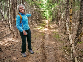
It does indeed lead to a firing range within the first half mile or so. The road here is wide and might not seem exciting, but it’s a microcosm of the beauty of the Maine woods. Conifers in many shades of green and mosses and lichens in every other shade of green and silver line the road, set off by the rusty hue of masses of fallen pine needles. We surprised a flock of turkeys in the woods to the west.
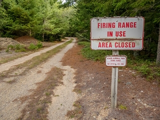
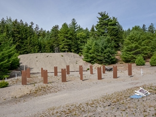
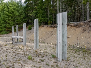
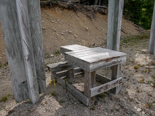
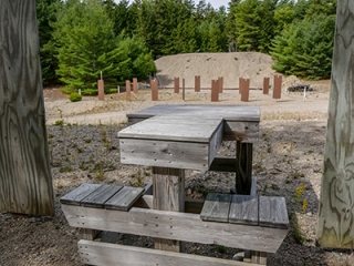
The firing range was somehow rustic and pretty elaborate at the same time. Fortunately it wasn’t in use when we were in the area, so we were able to hike through.
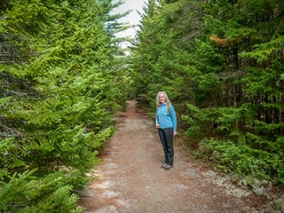
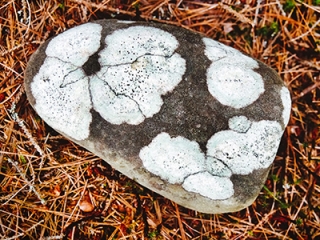
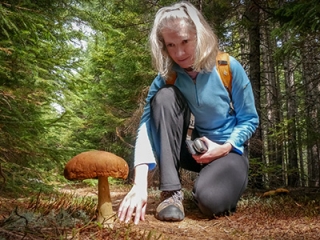
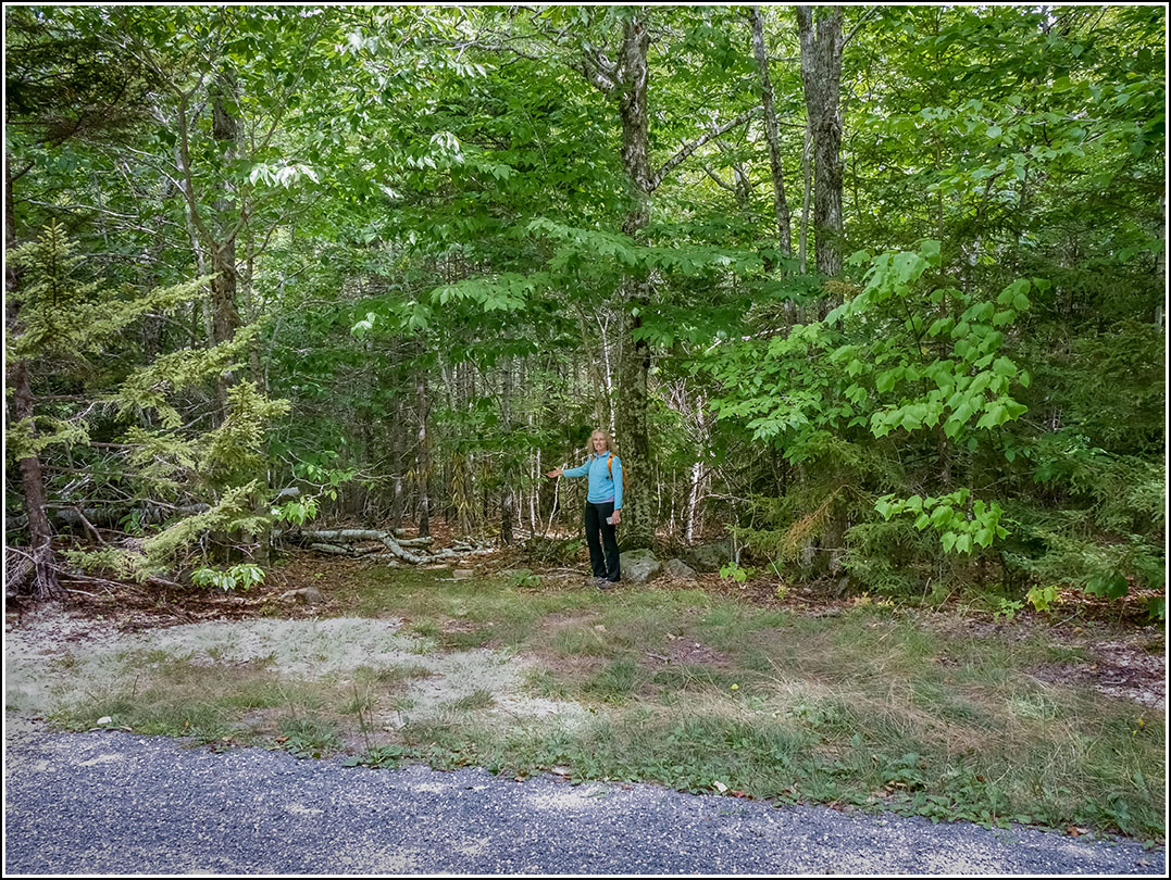
Just past the range, the road narrows and begins to travel through the same beautiful green and brown and orange woods, just closer at hand and more intimate. The road/trail offers soft footing from all the fallen pine needles and the sunlight falls softly through the trees as well. We found some interesting mushrooms and lichen-covered rocks. And eventually we came to the point at which I intended to see if we could locate the start of the also-long-abandoned Green Mountain Trail.
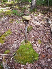
I had estimated coordinates from old maps and some educated guesses about where such a trail might begin. We didn’t see anything right at the spot we had identified ahead of time, but a hundred feet or so further on I happened to notice some blue flagging tape tied around the base of a tree, just off the trail to the east. I also spotted some obviously disturbed ground, a likely sign that people had been walking in that spot. But I still wasn’t convinced—I’ve encountered any number of reasons for flagging tape on trees—until I saw a small rock atop a skinny stump, serving as an impromptu cairn. It was so funny looking and un-subtle that I actually laughed out loud, and knew I was onto something.
I followed the trail for only a short distance, knowing we were not prepared today for the type of climb my friend Angie had described from her exploration of the Green Mountain Trail. But I was eager to record enough of a tracklog and a few waypoints along the way to determine if we were in the right spot and were headed in the right direction.
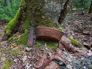
After doing so I rejoined Rich on the trail. Just a bit further we found another cairn, and a few yards into the woods we noticed a strange metal decorative object at the base of a tree. These didn’t indicate any apparent path but it was certainly interesting and something worth mentioning to our local friends to see if they might know anything about it.
Before long we crossed the western end of the Canyon Brook Trail, and soon after made the little loop around to emerge on the carriage road leading north to Bubble Pond! We had ended up hiking the entire length of the old road—that is, the length that remains, from Route 3 until it runs into the carriage road that overlaid the northern end of the Boyd Road—and found that it’s actually in excellent condition. In a few spots on slopes bordering the small creeks that cross the road, particularly as it nears its northern end, some erosion damage makes for slightly tricky footing.
For a few minutes we entertained the idea of walking the carriage road to the northern end of Bubble Pond and then getting a bus back to Blackwoods, from where we could have easily walked to our car. But it turns out that the buses have altered routes this year, and the bus we could have taken last year to go from Bubble Pond to Blackwoods no longer follows that route. We would instead have to take the Park Loop Road bus to Sieur de Monts and then the new Blackwoods bus to Blackwoods.
With another activity in mind for today and a dinner reservation tonight, we didn’t want to risk it. We decided to backtrack along the Boyd Road under our own power. We did so with only a few complaints here and there, and it was just as enjoyable a hike on the way back.
Our next activity for today was to look, once again, for USGS bench mark K 19 near Little Long Pond. We knew we had a better chance today since at least we were looking in the right area, but unfortunately it wasn’t to be. We both were fooled by a green circle on an open ledge that looked an awful lot like a benchmark from a distance, and got more excited than we probably should have.
When we got closer we could clearly see that it wasn’t the mark. And although we searched the area extensively, we couldn’t really find any other probable ledges in the area. Everything was covered by at least an inch of old pine needles, so it’s going to take some digging. One ledge is a slight possibility, but we’ll need a metal detector to know where to clear the moss. We’ll try again!
We went back to Bar Harbor by way of Stanley Brook Road (one of Rich’s favorite drives in the park) and the Park Loop Road.

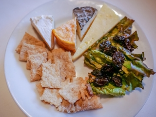
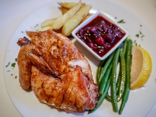
Dinner at Red Sky in Southwest Harbor was exquisite as always. We started with the amuse of salmon mousse and bread, then ordered the cheese plate and scallop tostada for our appetizers. The roast chicken from Sunset Acres Farm was irresistible to both of us. We were considering ordering a martini until Rich saw Thirsty Botanist IPA on the beer menu—just perfect for me. He enjoyed a pilsner that had a fresh sweet honey flavor. We were too stuffed for dessert, but we already made reservations for Thursday, so maybe then! We listened to our Maine music on the drive back.
