I wouldn’t expect that a PennDOT survey mark datasheet would be a cause for an outburst of laughter, but that’s exactly what happened when we came across a 1977 survey station designated OAK TREE LODGE, on the grounds of an establishment called Oak Tree Lodge.
Oak Tree Lodge was apparently a nudist colony. That’s hilarious and so … 1977. What made it even funnier was that it most recently served as a religious retreat center! We just had to check it out, and we added it to a short list of survey marks to search for today.
A possibility
The first one on our list was TTS 22 T. I don’t quite know how we missed noticing this benchmark on the topo map, but somehow when I found the datasheet on PennDOT’s site a few days ago, it was a new one to me. In addition to being a USGS mark, it is also in the NGS database, so it’s doubly confusing why we never looked for it before.
Anyway, it seemed like it might be a simple find—and it still might be, once the vegetation is down in the late fall or winter. Rich pulled off the side of Route 6 and I climbed the steep bank. I found a few large boulders that would be suitable for a benchmark, but the mark wasn’t on the only one that I could access. The other boulders were covered with thick overgrowth.
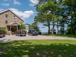
After that mild disappointment, we turned our attention to the former nudist colony.
What you’ve been waiting for
We drove up to the site to find a fancy, relatively new (or newly renovated) building and a frenzy of construction activity underway. We parked and began to walk toward the coordinates. A man approached us. He introduced himself as the groundskeeper, Mark. We expected that he might have come across the benchmark at some point, but he had no knowledge of it. He said we were welcome to walk and look around, though, and gave us a few tips about where we might find a concrete slab. At the coordinates, we found nothing but grass. Nearby is a fire pit, which Rich surmises may have been built atop the slab, but there’s really no way to find out other than to dig through inches of soot, which we weren’t about to do.
A few women were sitting in a small pavilion to the right of the building, right on the edge of the ridge with a wide view over the valley. One of the women appeared to be in charge and we told her that we were looking for an old survey marker. Before we even mentioned anything about it, she laughed and said “You know this place used to be a nudist colony, right?” Of course I said, yes, we saw it on the datasheet, and had to run right up here! She then explained that they were turning the retreat center into a treatment facility (still called God’s Mountain) for women. She was extremely enthusiastic and walked around with us while we searched. She didn’t know anything about survey mark hunting but was familiar with geocaching.
Rich and I continued to look around the property but didn’t see anything that looked promising. The location of the coordinates doesn’t quite line up with where the mark is indicated on the diagram, so we were sure to widen our search considerably. It even occurred to me that the little pavilion might have been built on top of the concrete slab (it is east of the building, or at least east of the existing building; we don’t know how the original structure may have been altered). And it would be a good place for a flagpole, which is long since gone. Needless to say there was no way to get a look underneath the pavilion, so we weren’t able to test that hypothesis. Old aerial images don’t offer a high enough resolution to determine much about how the site looked historically, and I wasn’t able to find any other information about the area in the 1970s. So this one will remain a very interesting mystery, for now!
MOOSIC
Because we were already in the area, we decided to scout out triangulation station MOOSIC as well. I’ve been looking at this triangulation station on the topo map for years. Because there is a windmill farm along this ridge, I never felt comfortable just hiking or biking in, although I know that people do hike here upon occasion, apparently without incident. Today when we drove past the gate across the track road leading up to the ridge, we noticed that the gate was open. This was our chance!
We drove toward the coordinates and found a fenced-in site on a concrete platform with a small building and a tower (a radio tower, not a windmill tower). It wasn’t apparent whether the coordinates were actually inside the fenced-in area. If that’s the case, I doubt the mark is still recoverable. But with the height and density of the vegetation surrounding the site, I knew it would be extremely difficult to find a mark set on bedrock flush with the surface, even if it was technically accessible.
It’s probably a good thing that we decided right away not to bother with this mark today—Rich was feeling anxious about the reason the gate was open (was someone working up here, and what if they left and locked us in?). We left the site pretty quickly and on our way out Rich did spot a worker’s truck in a pulloff close to the gate, so the scenario of us getting locked in there certainly was possible. Maybe we can try again on foot another day.
And the final reward
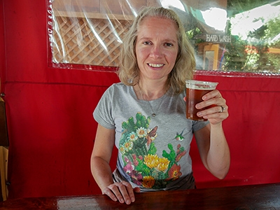
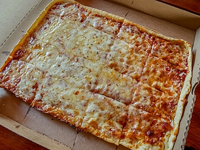
As you’ve probably guessed by now, the end goal for the day was to relax at the Waymart Hotel with another pizza. This time we tried their “Old Fashioned” style, which has a different sauce. I think I liked it better than Rich did, but we both enjoyed the experience and the peace and warmth of a lovely summer afternoon!