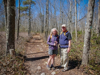
After a relatively mild early and mid-winter, we’ve suffered through a brutally cold and snowy March and April. Finally yesterday and today were beautiful days with sunshine and temperatures in the mid 60s! I wasn’t as stiff or sore after yesterday’s Death Hike as I expected, and I was thrilled to go for another hike today at a new place for us, Bear Creek Preserve. We traditionally hike in the morning hours before heading to the local showing of the Banff Mountain Film Festival World Tour, and today was the day.
We picked up Dad around 10am and took the expensive but peaceful Turnpike to Route 115. What a mess of potholes Route 115 is! Even for PA, it’s unbelievable. We bounced along for about 6 miles until we reached the turnoff for the Bear Creek Preserve, Shades Creek parcel.
As soon as we turned into the parking lot, we saw a sign reading “Event” with an arrow pointing up the hill toward the visitors center. We drove to the center, where we learned that the event had been an Earth Day hike at the preserve, and it had just ended. The gate was only unlocked for the event and would be locked soon after, so we would have to park at the lower lot—good thing someone told us that!
We returned to the base of the hill and parked in the main parking area right off the road. We were probably the third car there at the time. Another hiker in the lot advised us to wear bug spray because ticks are rampant here.
We started off back up the hill toward the visitors center, this time on foot, planning to take either the yellow or the green trail. We apparently missed the beginning of the yellow trail but no matter, we got on the green trail just behind the center.

Usually by this time of year the trout lilies, violets, and spring beauty are out. But this year the trees are still completely bare and there wasn’t a single wildflower sighting throughout our hike. On one dry, sunny hillside, right in the middle of the trail, we spotted a few tiny shoots of something (a grass?) just poking through. It was inordinately exciting to see this bright new growth!
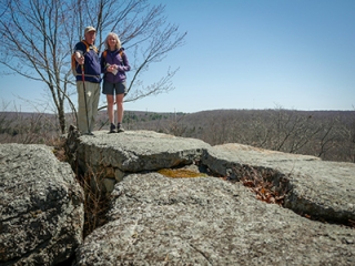
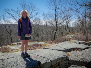
After a short hike on the green trail we came to its intersection with the yellow trail, which would lead us to a spot labeled “overlook” on the map. We had to check it out. The overlook is a wide ledge that drops off sharply to a ravine below. “Remind you of Sam’s Point?” Dad asked when he saw it. Well, not quite, but it has a similar profile although it’s not easy to recognize since the rock is less exposed. And it certainly lacks Sam’s Point’s expansive views over the valley. I think it was a subtle hint that he wants to go back to Sam’s Point soon.
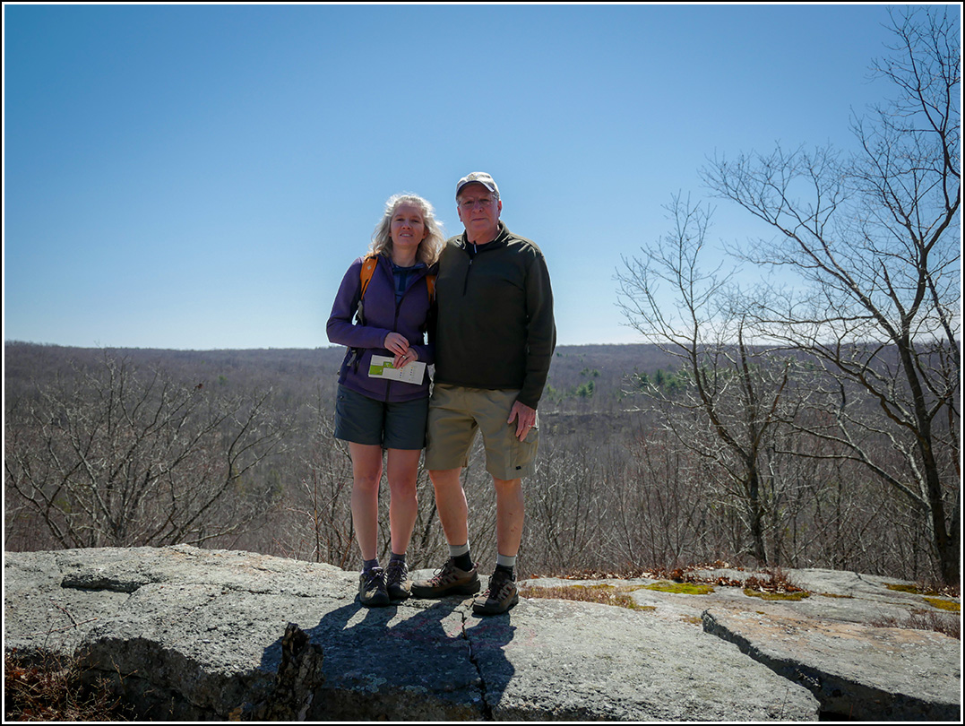
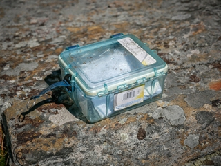
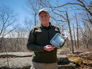
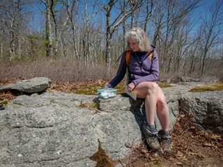
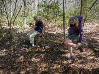
While we were poking around at the overlook, I spotted a nice crevice in the rock and wondered if there might be a geocache hidden there. There wasn’t, but we used Dad’s phone to check Geocaching.com and we found that we were only 65 feet from a cache! Rich found it easily and took a precarious walk through probably-tick-infested brush (fortunately we didn’t see any) to retrieve it. The container hadn’t been sealed properly and it was wet inside, including the log sheets, which was salvageable nevertheless.
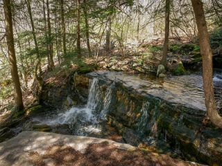
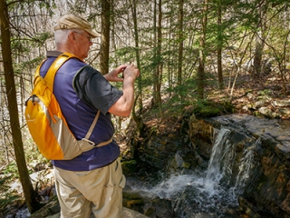
We continued on along the rocky yellow trail to where it intersected the green trail again, and we went back on green to head toward the waterfall. The mostly dry trail was just a bit mucky in spots as it descended toward a shady glen where a tributary of Shades Creek falls over a series of short cascades. Rich explored and took lots of photos and video clips here, while Dad and I mostly snacked on carrots and explored a little ledge off to the side that appeared that it would offer a good view of the falls, but really didn’t.

We looped back around on the green trail, gaining elevation and passing through drier, more open woods and then into meadow. The trail, while still peaceful, was getting busier by now. We branched off again at the next intersection with the yellow trail, which this time led us down low through a swampy area, cool and dark, and eventually back out to the pathway down to the parking lot. In just under four miles, we saw so many different types of environments! This place is worthy of much deeper exploration.
From the preserve, we continued southeast on Route 115 and then worked our way to Kunkletown via back roads. From here we went UP and over the mountain at Smith Gap, an experience that Dad doesn’t really care for, apparently (Rich and I enjoy it).
When we stopped at the stop sign at the intersection of Point Phillips Road and Mountain Road, I happened to look to the right and spotted a benchmark on a post! I’d had that mark on my list to search for, but I thought it would be a much more difficult recovery. (Marks on concrete posts near intersections tend to be dug up, plowed over, or buried, more often than not.) I hopped out of the car to document the mark while Rich pulled off on the side road.
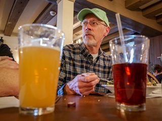
We made it to the Point Phillips Hotel just in time to meet Joe at 3:00 (Chris, who had been bouldering at Nockamixon State Park, joined us about 30 minutes later). While we waited for Chris, we started with beverages (Fat Tire for Dad, Hop Devil for me, and iced tea for Rich since he was driving).

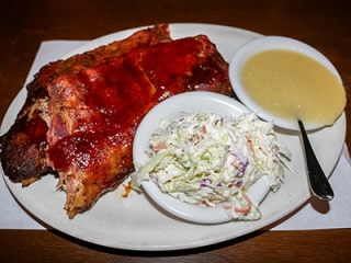
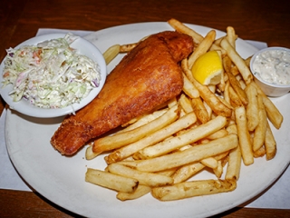
Chris arrived and then we ordered: the pork and sauerkraut meal for dad, fish & chips for Rich, bratwurst for Joe, patty melt for Chris and baby back ribs (of course!) for me. As usual, the food and conversation were great! The place was busy too, much more than last year, for some reason. Even though I put half of my ribs aside for tomorrow I was still stuffed after half the rack and the sides. Rich was beyond stuffed as well. But Dad, Joe and Chris all wanted dessert—the famous apple tart. Big bummer that there was only one left! After a big fight (just kidding; very civil discussion) Dad ended up with the tart, and Joe and Chris ordered cheesecake.
We hung around at the table for a while, and then slowly made our way to Northampton Community College for the film festival. Dad rode with Joe while Rich and I took a few extra minutes to scout out the site of a nearby airway beacon (it’s gone) and another USGS benchmark (which may still be in place, but we couldn’t find any sign of it).
The films featured a not-inspiring (you’d have to see it) one-armed climber, a 90-year-old figure skater, and the deft “mountaineering” of ibex. The standout, we all agreed, was “Into Twin Galaxies,” the epic story of three adventurers crossing Greenland by kite-skiing and kayaking and finding an unexplored river. Our only disappointment was the fact that “Dreamwalkers” a film about highlining in the Faroe Islands by Chris Eyre-Walker, wasn’t included in this year’s lineup at the college. We briefly met up with Dave at intermission, but lost track of him after the show.
To Dad’s relief we took Route 33 and the interstates home rather than the back roads. We were home and resting just before midnight!
Today's Geocache
- Owner: blitz10035
- Location: N 41° 10.593' W 075° 42.194'
- Log Type: Found it
- Date: 22 April 2018
- Original Geocaching.com listing
Hi, blitz10035!
It’s been a long winter, and today’s beautiful weather offered the perfect opportunity for a hike at Bear Creek Preserve, a new spot for me, Rich, and my dad. We haven’t gone geocaching for a long time, and it wasn’t part of our plans today. But when we took a break to explore the overlook along the yellow trail, I noticed a small crevice in the rock that looked like it would be a perfect hiding spot for a geocache. There was nothing to be found in that spot, but the idea inspired me to check our phone to see if any geocaches were nearby. To our (mild) surprise we were within 65 feet of a geocache! Rich searched around and found it quite easily. Unfortunately, the container had not been properly sealed and the contents were wet, including the log sheets. We signed our names and traded nothing. Thanks for your efforts in placing this geocache!
Zhanna
This is my first time visiting the Natural Lands Bear Creek Preserve. This morning, while on our way to the Banff Mountain Film Festival World Tour at Northampton Community College, we (Zhanna, her dad, and I) planned to hike and explore a small section of this preserve. When we arrived at the yellow trail overlook Zhanna suggested that we check for any nearby geocaches. Her smartphone immediately indicated that there was actually one right here! An easy find, of course, even though it was hidden quite well. The bad news, however, is the contents were soaked. The container wasn’t sealed properly because the Ziploc baggie with the log sheets inside was trapped under the edge of the lid. This allowed water to seep inside. With some care we manage to sign the damp log sheets, but there wasn’t enough time to try to dry out the container. Anyway, thanks for placing this geocache. We enjoyed the area and the trails. And we hope to return soon for further exploration.
~Rich in NEPA~

