
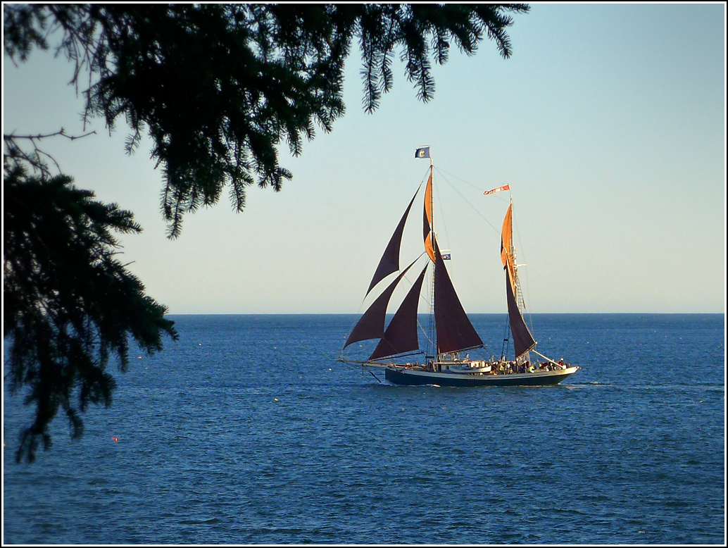
What a great day of exploration! Anticipating a lobster lunch we began with a very light breakfast, bagels (potato and chive and salt & pepper, both with veggie cream cheese) from a Slice of Eden. Coffee and Earl Grey tea, too. We took them down to our gazebo on the waterfront, where we sat in pure sunshine and a mostly light breeze and ate and talked for over an hour, while watching the cruise ship Anthem of the Seas and the goofy crane-like arm thing on top going up and down (what is it? a ride or observation tower of some kind?).
On our way back to the room, we happened to notice a silver loon charm in the window of the shop where we bought a charm last year (the Russian dance party place) and we stopped in to buy the loon, of course, because it reminds us of the loon we heard at the arches on Saturday and the loons we saw on Jordan Pond. Not to mention all the loons around us all the time, but we don’t really want or need to be reminded of them.
Our first idea for the day was to hike the Hunters Beach Trail and then try to find the Hunters Cliff trail and parts of the abandoned Seal Harbor Shore Path.
According to the 1915 Path Guide of Mount Desert Island, Maine by pathmakers Waldron Bates, Edward L. Rand and Herbert Jacques, the Shore Path
… runs along unusually beautiful rocks and cliffs—in places spanning chasms by means of bridges and in others blasted out of the face of the rock. The views of the open ocean and the surf effects after an easterly storm are very fine. Anemones and other interesting forms of sea life may be found in the pools at low tide.
It should be apparent from that description why we were keen on finding what’s left of the Shore Path!
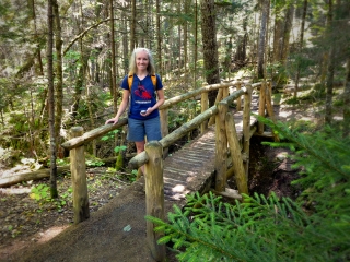
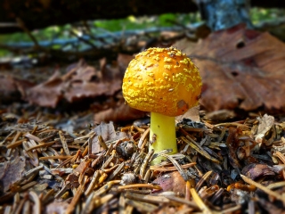
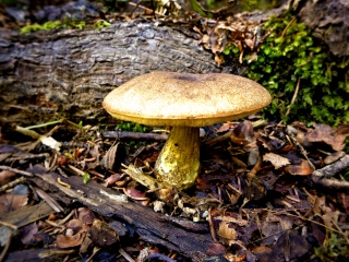
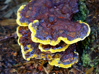
We drove to Northeast Harbor and parked at the three-car pulloff for Hunters Beach along Cooksey Drive (some maps call it Sea Cliff Drive). One other vehicle was there when we arrived. We headed into the woods and took a very slow walk, enjoying the beautifully warm dry day and the smell of balsam in the air! Soon we came to a neat wooden bridge over the stream and spent time taking photos of he bridge and nearby mushrooms. A few people passed us at this point, but they were the only people we saw on the trails today.
At the end of the Hunters Beach trail we turned right onto the unmarked Hunters Cliff trail. While unmarked it’s still very easy to find since the Hunters Beach trail basically leads you right onto it. In fact, we realized we’ve been on the very beginning of this trail before, years ago while looking for the Hunters Beach Hunt geocache.
The trail climbs steadily but easily; the most challenging part is avoiding the poison ivy growing all over the first hill. Fortunately it didn’t last long, and once we were out of that section we didn’t see any poison ivy for the rest of the day (well, I saw it in one other spot that I’ll get to soon). About halfway up the hill, I spotted a brown NPS witness post which usually means that a boundary marker of some kind is nearby. Right in front of the witness post was a disk on a rod! Cool! It was a boundary marker S 226. We wondered if it was part of the “S” series from which we found three marks a few years ago.

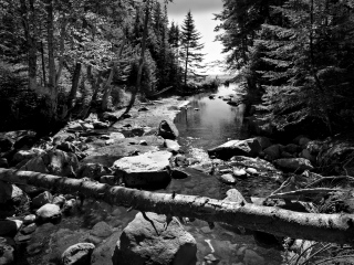
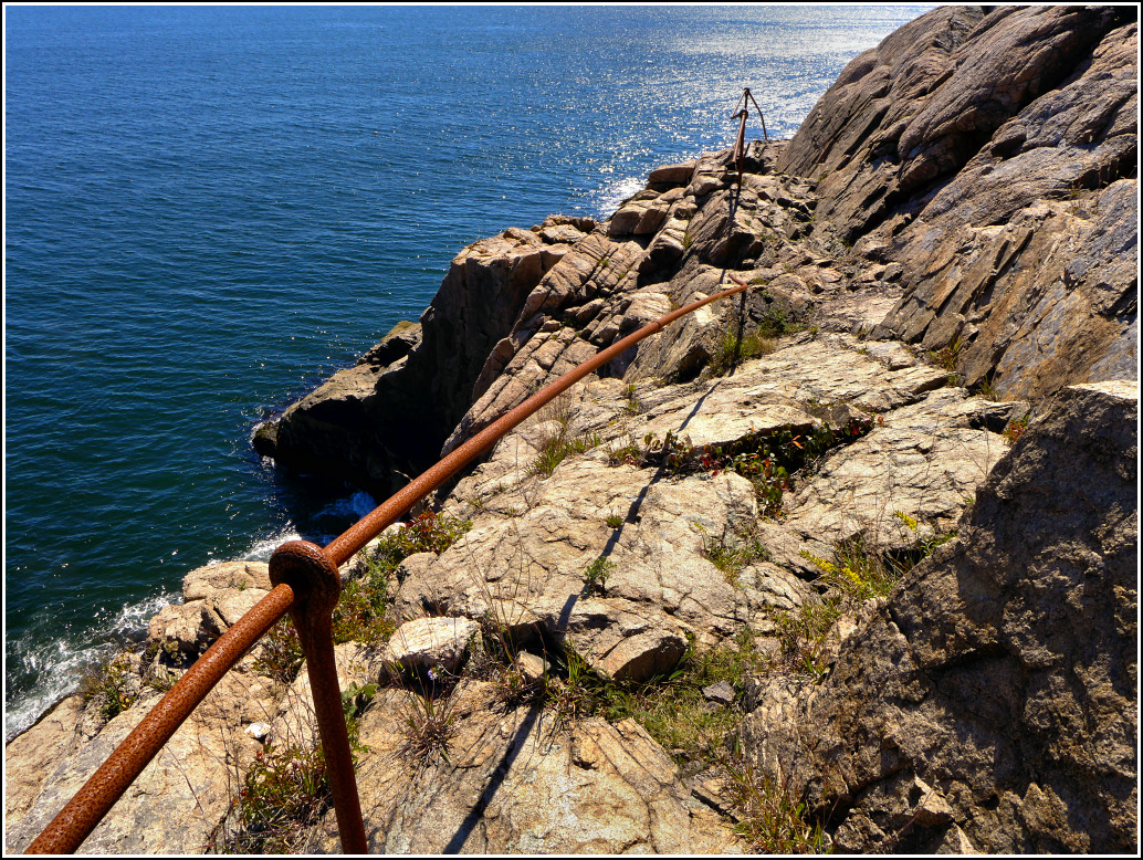
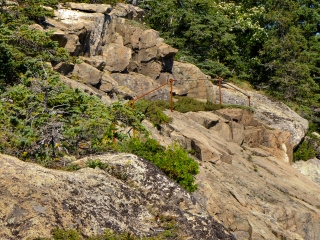
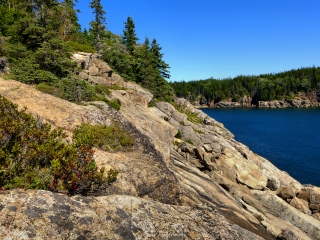
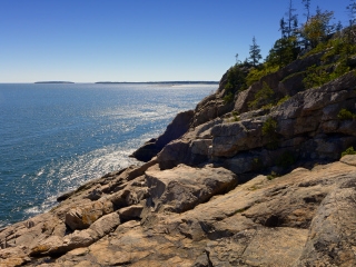
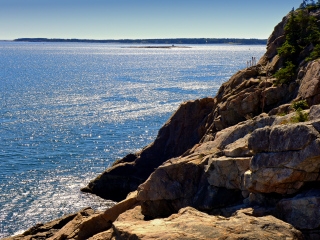
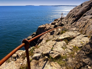
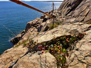
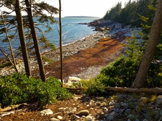
We continued on up the path, which becomes more open and rocky as it climbs. But for its proximity to the ocean, it reminded me a lot of the Potholes/Eagles Crag area. We were navigating toward the first of two waypoints provided by Don Lenahan in his blog “The Memorials of Acadia National Park,” which were supposed to be junction points leading us out to the old Seal Harbor Shore Path. Finding evidence of that trail (in the form of old railings) was our main goal for this hike.
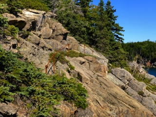
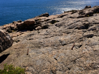
For some reason, we didn’t have much luck with the first waypoint. I was able to get out on the rocks nearby, but still not in the right place—I could look to my left and see one of the railings, and another to my right, but I couldn’t really access either of them from the ledge I was on. I took some photos and we moved on to continue along the Cliff Path and navigate toward the second junction point. This worked out a lot better. The provided coordinates were about 85 feet off from my GPS reading, but we simply headed toward the cliffs in the only spot that appeared open and found a cairn.
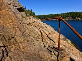
Rich waited while I pressed through some blueberry bushes and a small pine, following cairns as I went, and emerged on a ledge at (and well above) the water’s edge. Immediately at my feet were two iron rungs, cut off and bent down flush with the rock. I went forward and to my left, heaved myself up onto a ledge and saw the second handrail before me! Amazing! I walked along this ledge, taking photos so I could share the experience with Rich. (I was certain to take a photo of the little bed of poison ivy up there too, just for him. ![]() ) The rails seemed pretty sturdy, except for the broken one in the middle and at the south end, of course.
) The rails seemed pretty sturdy, except for the broken one in the middle and at the south end, of course.
I hopped back to the Cliff Trail, eager to share my adventures. Rich was thrilled too! We continued on the Cliff Path, which reached a a high point not long after the point where I’d gone out to see the old railings, and then began to descend back into the woods and head northwest back toward Cooksey Drive. We walked Cooksey Drive back to the car, maybe about a half mile walk, easy on a mostly level, shaded road.
No trip to Maine would be complete without a lobster meal … or several. Our usual spot is Beal’s, and non-coincidentally it’s not too far from where we were just hiking in Northeast Harbor. They’ve classed the place up a lot, but haven’t made it cheesy or touristy. Just efficient and modern, and keeping some of its old charm as well.
I had the usual live lobster (1.76 pounds) with butter, while Rich broke with tradition this year and had a lobster roll, “fancy” centennial style with cucumber dill mayo (it was very light, just a hint of flavor, and a fantastic combination!). We also, in another break from tradition, ordered two draft beers instead of wine (Lobster Ale and Green Blaze IPA). We chose a sunny table in the corner of the sloping pier (Rich was slipping backwards the whole time!) It was heavenly, sitting in the sun (but with the wind blocked), eating lobster, listening to good old music and getting a back scratch and rub from Rich! I didn’t want to leave, ever.
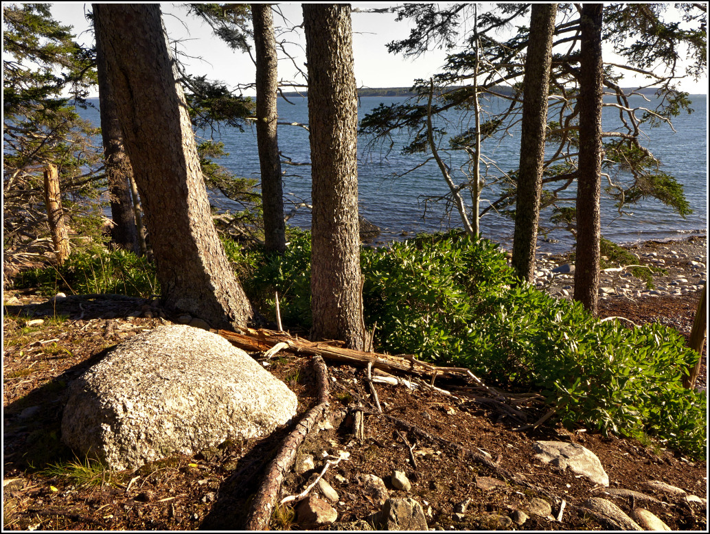
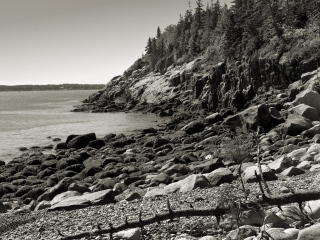
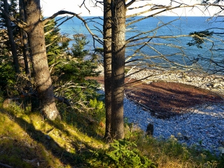
But we had one more idea in mind for the day. We wanted to try to look for the Bass Harbor Lighthouse trail blogged about by JR Libby. We followed his directions and found it easily. It looks like the entire trail will travel about a mile east toward Wonderland. We followed it through woods, up and down typical Acadia landscape, then out on some grassy sea cliffs overlooking Whistler’s Beach. We took photos here and enjoyed the view and more than anything else, the solitude!
The trail was mostly easy to follow, but not always easy to hike as we got further along because there were so many blowdowns. It did help to see where branches had been cut because it gave us confidence that we were on the right track. But about a third of a mile from the end, just judging by the very crude map on my GPS, we ran into a very thick bunch of spruce trees and other brush followed by a blowdown that looked, if not impenetrable, at least very unpleasant. It was getting late, darker and cool by this point, so we decided to turn around here and save the rest of the challenge for another day. I was so thrilled just to have found the trail and hiked so much of it!
We were both too stuffed for supper, so after cleaning up a bit in the room we shared a Tastykake peach pie and some wine. I guess that was our supper!
