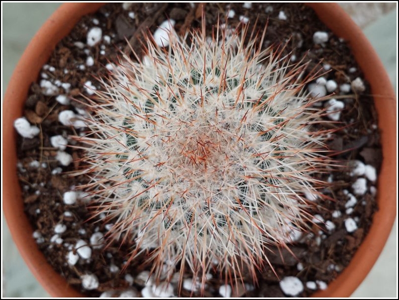
The first weekend of August always means Montrose Blueberry Festival (at least for Rich, Dad and me). This year’s festival was as tasty (blueberry pancakes!) and fruitful ($1.50 cactus pups!) as usual.
Another tradition, following the blueberry festivities, is a hike at Salt Springs State Park, which is just a short drive north of Montrose on Route 29. We had planned to search for two USGS benchmarks near the park.
Just before turning west onto Silver Creek Road, we decided to check out the relatively new bridge on Route 29. No real surprise—we found a PennDOT disk set into the southeast wingwall. It is in good condition. The “57” as the second number in the designation seems to give further evidence for our hypothesis that this part of the designation stands for the county (numbered alphabetically).
USGS bench mark 2 W was the first mark we had planned to look for on our way to Salt Springs State Park. The description specifies only that the mark is west of the stream, although the topo map shows the mark near the northwest corner of the bridge. The situation looked promising when we arrived: the rusty guardrail seemed to indicate that the bridge was untouched for decades. Unfortunately for us, it looks like the bridge deck was repaired and new concrete was poured over the existing foundations, including the guardrail post bases. The date “2011” is scratched into the concrete at the southwest corner of the bridge. We checked all corners and both sides of the bridge, but found no sign of the disk.
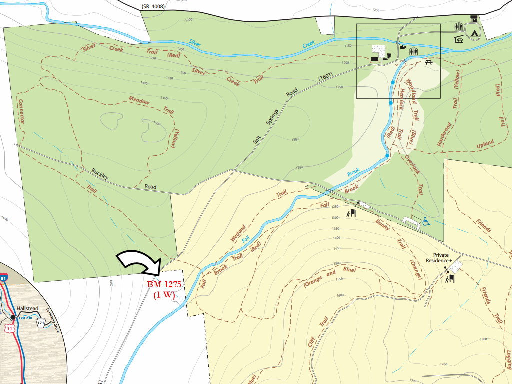
1 W was the second mark we had planned to look for near Salt Springs State Park. But as often happens, things didn’t go exactly according to the plan.
In part due to the location of this bench mark, we chose a new route for today’s hike. We hadn’t yet spent any time investigating the new trails in the “Friends of Salt Springs State Park” section, and we were doubly interested since the Fall Brook Trail in this section of the park comes reasonably close to 1 W. Our plan was to park in the lot near the private residence on Buckley Road, then hike the orange-blazed Bunny Trail northwest toward Fall Brook where it, unsurprisingly, intersects with the Fall Brook trail. We would then take what the map labels the “Connector Trail” to cross Fall Brook and hike northwest a few hundred feet to Salt Springs Road, near the coordinates for the mark.
The Bunny Trail quickly took us deep into the woods, on an easy grade down toward Fall Brook. We followed the red-blazed Fall Brook Trail and hiked alongside the brook, looking for signs of the supposedly white-blazed Connector Trail. Hmm … we didn’t see anything, and soon we were heading uphill and south—away from Fall Brook. That means, according to the map, that we had already passed the turnoff for the Connector Trail.
Rich, Dad and I retraced our steps and, using the map, estimated again where we should find the intersection. This time, we found some faint blue blazes on the north side of the brook, but following them for a few minutes ensured us that we were in fact on the blue-blazed Wetland Trail, heading northeast rather than northwest. Where was the Connector Trail?! We searched the entire area on both sides of the brook without finding a single unaccounted-for blaze (white or otherwise) or signs of a trail. Eventually, we gave up and decided just to drive to the spot after our hike. Maybe we could locate the trail from the opposite direction.
A circuit through the Fall Brook, Bunny, and Bunny/Cliff trails took us back to our parking spot. We discovered a highly fruitful blackberry-picking spot along the way, just for future reference.
Salt Springs Road is narrow, usually muddy, and potholed (“No Winter Maintenance” for sure!) but we didn’t have too far to go, and Rich got us there in good shape. As we neared the coordinates for 1 W, what did we see to the right (north) side of the road? Yes, white blazes and a distinct trail leading into the main part of the park. And to our left at that spot, we saw a strange fenced-in plot that we first assumed might be a graveyard. Dad and I went to investigate. There were no graves, but we saw a large hole in the ground and some junk strewn about. We also saw what appeared to be the Connector Trail leading off into the woods toward the creek. We still had a bench mark to look for, so we’ll check that out next time.
Rich wanted to stay with the car in case another vehicle approached from the opposite direction and he needed to move. So Dad and I walked the 300 feet or so toward the coordinates. We first walked along the road, only to find that the GPS was pointing us about 50 feet into the woods … about 20 feet lower than the road. We backtracked and followed a path (most likely someone’s driveway) downhill and southwest so that we were on the same level as the forest floor. In this small wooded patch, we found two prominent boulders, both covered in inches-thick layers of soil, moss and evergreen debris, but one of which almost certainly holds the bench mark disk. Without a metal detector and serious tools for cleaning off the boulders, we really had no hope of finding it today, but I’m certain we’ve identified the location. We’ll try again next year! It was time for a leisurely drive home.
As we approached the Route 167 bridge in Hop Bottom, it occurred to me that I had never checked it for any survey marks, so this time, we checked. Dad and I found an old PDH disk set into the northeast wingwall. Often these PDH disks are unstamped or were at some point in the 1960s stamped by USGS. In this case, the stamping was the newer style that we’ve been finding on the new PennDOT disks. We noticed that the stamping is in a slightly different order than all of the other PennDOT marks of this type (year – route – county – number rather than year – county – route – number). I assume it’s just a simple error. The disk itself is in good condition.
A car stopped while Dad and I were looking at the mark. An older man got out and, to our surprise, didn’t ask what we were doing but asked if we knew anything about Hop Bottom. “Well, yeah,” Dad said, “I grew up here.” “Well, then you’re just the person I want to talk to!” the man said. He went on to ask where he could find the old Dairylea Creamery. He had worked for Dairylea in New York (Bronx, I think) and always knew about the Hop Bottom creamery. Now that he, for whatever reason, found himself in the area, he thought he’d see if he could find the building. Not much is left, but Dad explained how to get to the spot. The man then went on to explain how he had worked for several large food companies, including Chef Boyardee, throughout his career.
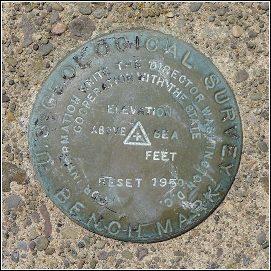
Our final find for the day is still a bit of a mystery. When we drove slowly by and I saw this disk, I was sure we had found 24 ETL. The disk was obviously one of the thick “cookie-style” USGS disks and not a new PennDOT disk, and it was in the wingwall specified by the USGS description. But when we checked, we found that although the disk is indeed a USGS benchmark, it is not 24 ETL. It’s stamped only RESET 1950. We assume that it is a reset of 24 ETL although that’s not certain. According to PennDOT’s bridge database, this bridge was constructed in 1952, which doesn’t really help to clear things up. It’s possible the bridge took a few years to be completed and that the mark was set at the beginning of the project.
