We’ve been telling Dad about Sam’s Point for a few years—it was about time we brought him to experience it for himself! We had an easy drive (thanks Dad!), and making a quick stop at the Basha Kill Wildlife Refuge along the way. Cohen’s Bakery was our next stop, and I think the one Dad was most looking forward to. He was not disappointed, as he kept reminding us all through the day! We loaded up, and I mean loaded, on prune danishes and apple fritters, and we each bought a prune strip for the trail. Then we set out on the long winding climb up Rt. 52 toward Sam’s Point.
We arrived at the Sam’s Point parking area at 10:30am to find that the lot was more than half full already on this absolutely perfect weather day. We signed in, paid for parking and noticed the hours (gate closes/locks at 7:00pm, 5:00pm as of October 8) and the fact that dogs are required to be on leashes.
As usual, we had a general plan for the hike, with an option to abbreviate it if desired. After almost eight years, I was thrilled to have the opportunity to look for SAMS POINT AZ MK! Only one geocacher has mentioned having found it, and it is not mentioned in any NGS recovery notes. Rich and I had used Google Maps and the box score data to plot estimated coordinates along the ridge. Of course, we had no idea how accessible those coordinates would be.
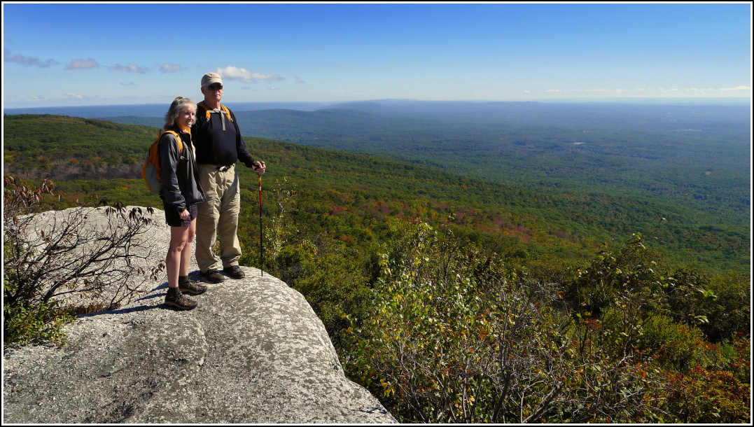
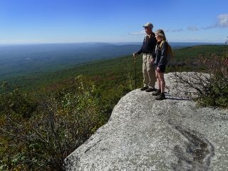
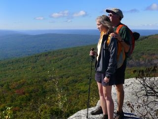
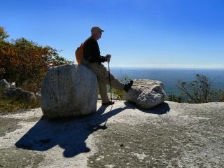
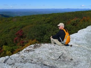
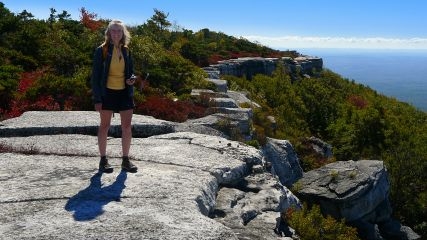
We hiked up to the observation area first; dad was already wowed by the scenery and views.
Rich and I had hoped to confirm that the SAMS POINT station mark was in place, but the area was covered with a thick layer of dried mud that would have taken a trowel to get through—and possibly a metal detector to find the mark itself. We also noticed when we got home that RM 1 doesn’t seem to be pointing directly toward the station. Next visit we will have to confirm and will know better (from our previous photos) exactly where to search. Both reference marks were in good condition.
We discovered that there is a relatively easy path to follow all the way along the ledges, with just a few jogs into the woods/blueberry shrubs here and there to avoid falling through crevices that are too wide to leap, from a point very near the observation platform to the ledge that holds the azimuth mark. Of course dad was willing to hop across almost anything, but Rich and I, with my recently injured knees, were more cautious.
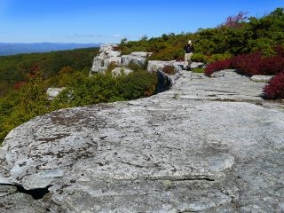
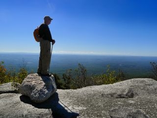
From at least a hundred yards away, Rich spotted a high ledge that he said would be a perfect spot for the azimuth mark. I suspected he was right; we just had to get there. Getting there involved mostly easy ledge walking, and a small amount of bushwhacking and more crevice-hopping. But he was right! I skipped ahead and spotted the azimuth mark easily. We aren’t the only ones who have discovered this ledge lately, though. The rock very near the mark is scrawled with graffiti in black paint. What is wrong with people?! All this beauty, and they can’t resist making their pathetic ugly mark upon it. We noticed that the disk is stamped SAM POINT instead of SAMS POINT like the other disks.
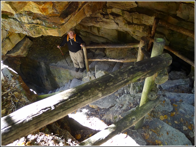
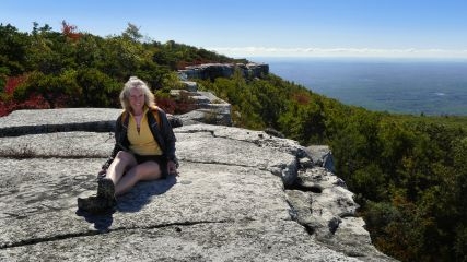
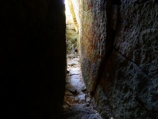
We then backtracked along the ledge and set out on our walk to the Ice Caves loop. Along the way we passed a Boy Scout troop trudging up the hill, half of whom looked like it was the last place they wanted to be, and we commented on how sad that was. Solar cells now light the caves within. Dad kept saying how the trail was so neat and like nothing he had ever seen. Rich and I were missing the wooden doors that used to exist at the caves, but loving the ladders and bridges and rock scrambles and crevices. Eventually we emerged on a ledge where we sat and snacked on what remained of our prune strips, dad’s homemade “Trop 25” and water. We finished the Ice Caves loop on our way out of the eastern side of Sam’s Point.
We took the long, scenic route back to the parking area—the loop around Lake Maratanza, planning to decide on Indian Rock when we reached the intersection with the trail leading to it. Other than a group of ignorant people with unleashed dogs, it was pleasant, an easy hike despite my slight concern over my knees, and so colorful.
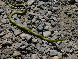
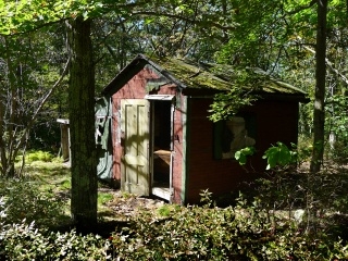
Dad wasn’t quite up to the extra 1.8 miles today (plus the climb up to the rock itself) so we decided to leave the hike to Indian Rock for next time. We finished the loop around the lake, spending some time at the berrypickers’ shacks and spotting an Eastern Green Snake along the way.
We investigated the visitors’ center again when we returned to the parking area. I had to laugh at the juxtaposition of a stuffed (as in taxidermy) owl with a stuffed (as in plush stuffed animal) chipmunk in his beak.
On our drive back through Ellenville we decided to stop at the D&H linear park (Summitville end). What a fortuitous stop! It was very interesting and after viewing the exhibits in the nicely done museum, we walked the trail around the property, crossing over several sturdy wooden bridges and investigating the stonework in the locks, and reading about the canawlers’ lives and work. And we also learned a new word: canawlers. Yes, people who worked on the canal.
