Today’s adventures began when we left the rest area around 7:00am, in a light rain that started to fall the moment we got on the road. We passed through at least five distinct periods of very light sprinkles, which unfortunately turned to heavier showers that lasted through the morning.
This was the first time ever that we bypassed L.L. Bean. The reasons? We simply didn’t need much of anything, and we had further adventures planned that would easily take up most of the morning. So instead of exiting the highway at Freeport as usual, we continued on to Augusta, where we picked up Route 3 (the Belfast-Augusta Road) and headed toward, well, Belfast, on the coast. We traveled through China, where for a time we followed a van advertising Damon’s Pizza and Italians—”Home of the Big Dave!”—which was pretty hilarious. Our route continued through rural areas, passing Saint George Lake and several wooded parks along the way. Soon we were passing Moose Point, the site of adventures both last year and in 2011—but we did not stop this time. This time we went directly to Fort Point, where we intended to search for several survey marks.
Cape Jellison Road, the way to Fort Point, loops around Cape Jellison and is typically a relaxed and pretty coastal drive (although Rich remarked that this is probably one of those little towns where really crazy things happen and everybody has deep, dark secrets). The crossing of two sets of defunct railroad tracks adds some more historical interest, although most of the interesting locations that we’ve seen here are at the state park itself.
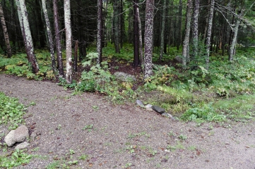
Our first goal was the recovery of D 147 along Lighthouse Road. It was raining moderately at the time, but that wasn’t enough to turn me away. What was, however, was the amount of brush, standing water, and probable poison ivy covering the twenty feet between the road shoulder and the boulder on which the mark is set. We spotted the disk easily enough from the road (with probably 99% certainty, since we can’t actually read the stamping without reaching the mark itself). But we simply weren’t willing to hike through the mess it would take to reach it this time. For now we’ll mark it as a note, and attempt the recovery again in drier conditions.
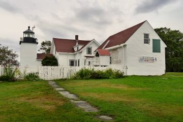
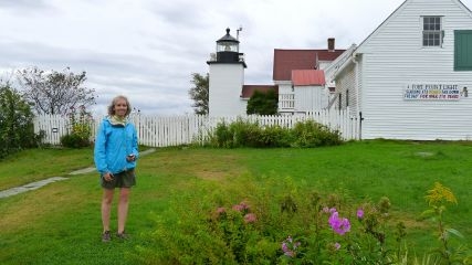
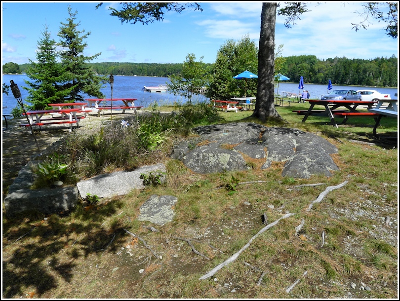
We then went on to Fort Point to take some photos of the lighthouse and ledge beacon, which are both NGS landmark stations, and to search for the array of tidal markers near the shore. The lighthouse and ledge beacon were easy enough to photograph, although the ledge beacon requires a heavy zoom to capture it well. By now the rain was nearly gone, and we were left with little more than moderate cloud cover—not even any fog. This gave me hope that we’d see sunshine relatively soon. We were empowered to continue hiking and to search for the tidal markers.
The first one was supposed to be on a large (un-missable!) boulder near the bluff. There were some confusing directions given concerning a trail from the lighthouse, which doesn’t really seem to exist anymore, or at least not in the sense that it did in 1948(?). Still, we figured if we followed the bluff we would eventually spot this huge boulder. We reached the beach without spotting even a single likely candidate.
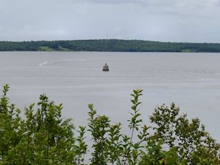
We then switched to the second one on the list, PE0382. Again, we couldn’t find anything that even seemed likely! Now back at the pier, where last year we found TIDAL A, we began to wonder what we were doing wrong. I took a close look at a large boulder protruding from the water and I swear I could see a disk on its surface! Unfortunately, at high tide it was unreachable without a boat or the desire to swim in 48° water, neither of which we had. Our best guess is that it’s PE0383, no. 2. Another mark, like D 147, that was so close yet so far!
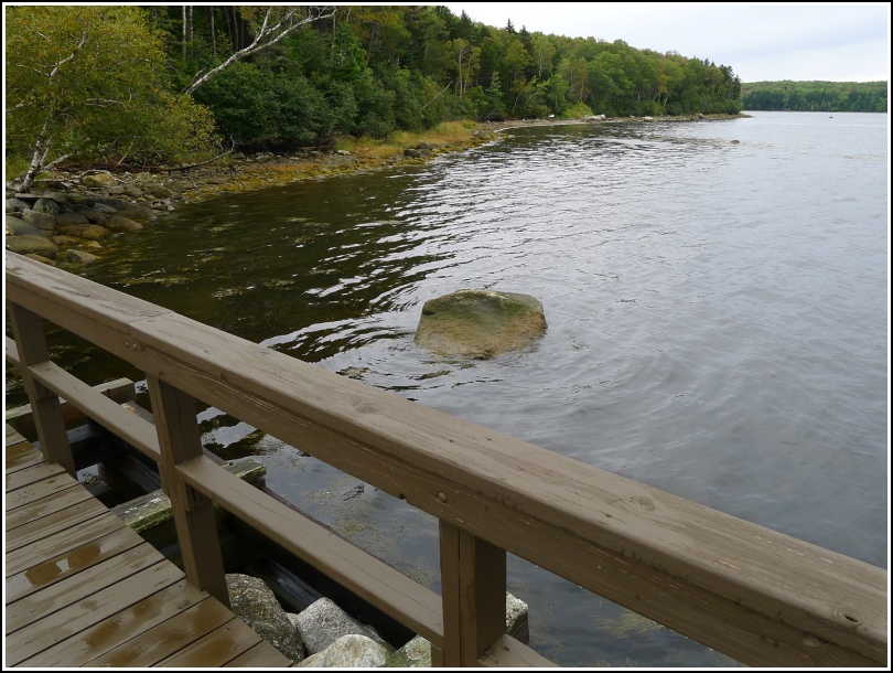
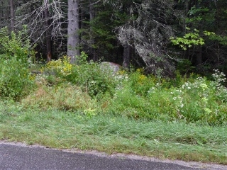
We had better luck with TIDAL B. Although the description still didn’t make much sense with what we were seeing on site, we poked around for a while in the wet woods and eventually found two boulders. Luckily, the disk was on one of them. Rich wrote up a revised description on the soggy datasheet while I took photos.
Still damp and feeling slightly chilled, we took a walk back, still looking here and there for any large boulders we may have missed. We didn’t see any, but we wandered onto the beach to attempt to walk up and down the shoreline. At high tide this isn’t easy, but we walked a few hundred feet in each direction (possibly more to the north) without seeing anything other than a really neat carved granite monument right on the beach. It has a drill hole in the top and a carved “U S” on the outward face, but no indication of its age or purpose.
By now the wind had shifted and warmth returned to the beach. As we drove away from Fort Point, sunshine appeared and skies cleared in an instant. Our next stop was the famous Bagaduce Lunch on Franks Flat, right on the Bagaduce River! This 67 year old eatery is reputed to have awesome fried haddock sandwiches—and do they ever! We also ordered the lobster roll; you can’t go wrong with fresh lobster on a bun, and it was delicious, and the onion rings were real onion rings made with thin slices of sweet onion and a light batter, a bit greasy but it somehow worked with all of the other flavors.
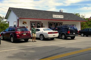

I was so thrilled that we finally came to this place. We had heard about it back in 2008, when we went to Isle au Haut via Blue Hill, but never stopped by. Fellow diners braved the breeze out on the pier but we stayed inland at a sunny table that still had an awesome view of the river.
And as an almost unbelievable bonus, there’s not one but two survey markers on the property! One is a USGS marker (highly sought-after!) and one is a MaineDOT marker (not as exciting, but still something fun to search for). Both were found easily. The USGS marker is the neater of the two, bright turquoise in color and situated in a boulder in the midst of the picnic tables.
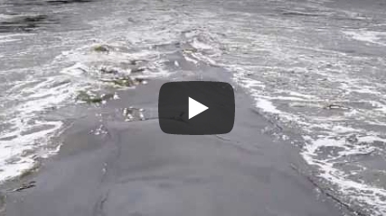
After eating we strolled across Franks Flat bridge to watch the powerful tidal outflow. I tried to video it but the thunderous MaineDOT trucks passing by probably ruined the atmospheric sound of gull calls. (Ever wonder why this road is so nicely paved and maintained? We did, until we tried the food at the Bagaduce Lunch. Now we know that the MaineDOT guys find any reason they can to hang out here during the summer season!)
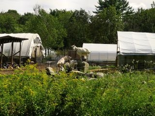
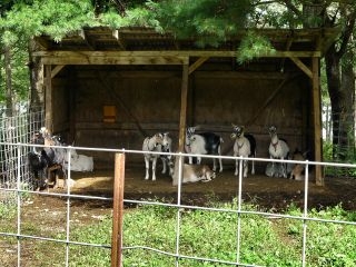
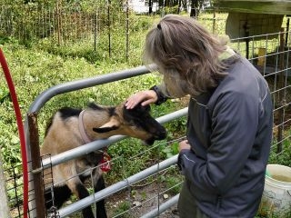
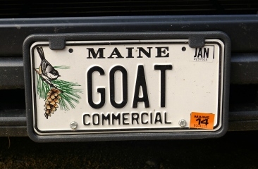
Our next stop was what I’ve been looking forward to since I discovered it online a week ago: Sunset Acres GOAT Farm!!! We drove down the sandy road toward the farm and immediately saw gorgeous goats perched on a pile of boulders! This was a good sign. A farmhand directed us to the bucks, yearlings and milkers before returning to his welding. The bucks and yearlings were absolutely adorable! My favorite turned out to be #1300 who came right over to me, gave me lots of goat kisses, tried eating my jacket. He had the funniest poof of hair on top of his head and a fuzzy little beard, and I couldn’t get enough of him. His little sister eventually became curious and came over to visit too, and she stole my heart as well.


We asked the farmhand about purchasing some cheese, and at that moment the farm’s owner, Bob, appeared and introduced himself. Bob is a rather jolly man who with his white beard looked somewhat like a goat himself (but not in a bad way!). He showed us his cheese room, where fresh goat milk curd was hanging to reduce the moisture content. His wife Ann, who looked familiar to me even though I’m sure I’ve never had occasion to meet her before, soon appeared. She sold us two tubs of spreadable cheese (“just plain” and parisienne, with herbs like tarragon) and confirmed that they would be at the Bar Harbor farmers’ market on Sunday. After a few more minutes of goat watching, we were on our way.
Once in Bar Harbor, we wanted nothing more than to rest after all of the day’s adventures. After a nap we took a quick run to the Hannaford for some necessary supplies, and then headed directly to Rosalie’s, of course, for our traditional first night pizza. It was absolutely stellar, with a perfectly crisp crust and sauce and cheese that went all the way to the edge. Shipyard Summer Ale rounded out the meal.
We took a quick and chilly walk to try to locate Acadia Park Kayak Tours, address listed as 99 Bridge Street (which we soon found out does not have a storefront, on Bridge Street or otherwise). We were in bed by 7:30pm.
