MILLER intrigued me because the trails and roads I saw on the topo map didn’t correlate with those on the aerial photograph. As we approached the area on Route 29 (not Route 92) we looked for the roads indicated in the description, but found no clue to where they might once have been even though they appeared on our maps. We tried any means to get close, eventually traveling up a long, winding road till I was willing to take my VW no further through the mud and ruts.
Upon turning around to head back down the hill, we were intercepted by a farmer who repeatedly inquired “Can I help you?” After explaining our mission and while sitting patiently through 20 minutes of old hunting and roaming stories from back in the day, we did extract some valuable information. We learned that the property on the mountain is now part of the DeNaples empire, and that we could park at a gate down the hill for access to the summit.
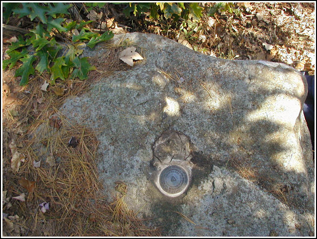
We parked in the indicated spot, crossed a pretty stream and small waterfall, and emerged on a woods road that passes some run-down hunting cabins and eventually deteriorates to no path at all. We then bushwhacked up a steep slope and emerged on another woods road, wide and easily traveled, that winds to the top. We followed it directly to a clearing, where we headed south on the north-south path that intersects the road. The station was approximately 30 feet into the woods on our right after hiking less than half a mile on this trail. We fought our way through the dense growth and easily spotted the disk on its boulder, framed by pine branches.
More difficult to locate was RM1. We searched and measured and found a suspicious-looking rock in the right location, but digging through the fallen branches, roots, soil, and reddish stone that broke off in our hands produced nothing but confusion. We put aside RM1 for a few moments and switched our focus to RM2. This proved to be a great confidence booster as we located it within minutes. It is set as described on a large boulder approximately 40 feet north of the station.
Determined to find RM1, we returned to the suspicious rock and continued the excavation. Finally, beneath layers of crumbling rock, we found the mark solid in its setting in the flat boulder. It seems likely that this very unusual arrangement occurred naturally, though we’ve never before seen anything like it.
After a lunch of pies and peanuts, we took our photos and notes and then headed back down the mountain. As we approached my car we realized that we could have avoided bushwhacking altogether if we had just gone a few feet further north to find the main woods road instead of turning onto the first road we encountered. While leaving the area, we discovered that the main woods road does in fact intersect Jenks Road, the main paved road in the area, near an old home and a trailer. The woods road is protected by a locked gate but is otherwise driveable to the top in a vehicle with proper clearance.
